Dinosaur Ecosystems

Ever wondered what it would be like to live in the world of dinosaurs?

I had the privilege of working as a filmmaker and editor on a Massive Open Online Course (MOOC) — an online video university course — for Hong Kong University. I spent an intriguing month filming in Inner Mongolia and two weeks in the halls of the Museum of Natural History in New York. Here’s the official trailer for the course, which will launch on edX on February 8, 2017.

This course will take you to the Gobi Desert of China to show you exciting fossils from the Late Cretaceous fossil site of Erlian. We will also visit leading international museums and institutions and see beautiful scenic sites.

Join us to find out more about dinosaurs and how their ecosystems are reconstructed! Enroll now!! It’s FREE!!

Series IIA

Read this story online as it ran in the South China Morning Post.

Land Rover Series IIA in Thailand

Land Rover Series IIA in Thailand

It feels like hours since we last stopped. I’m cramped from sitting hunched over in the back and my legs and arms are slippery with sweat on the vinyl seats.

“Ugh, ooofff, damn!” I grunt as we bang through a pot hole, the jolt making my spine throb. Our Land Rover Series IIA bucks like an angry bull, its suspension rigid with age after half a century on Thai roads.

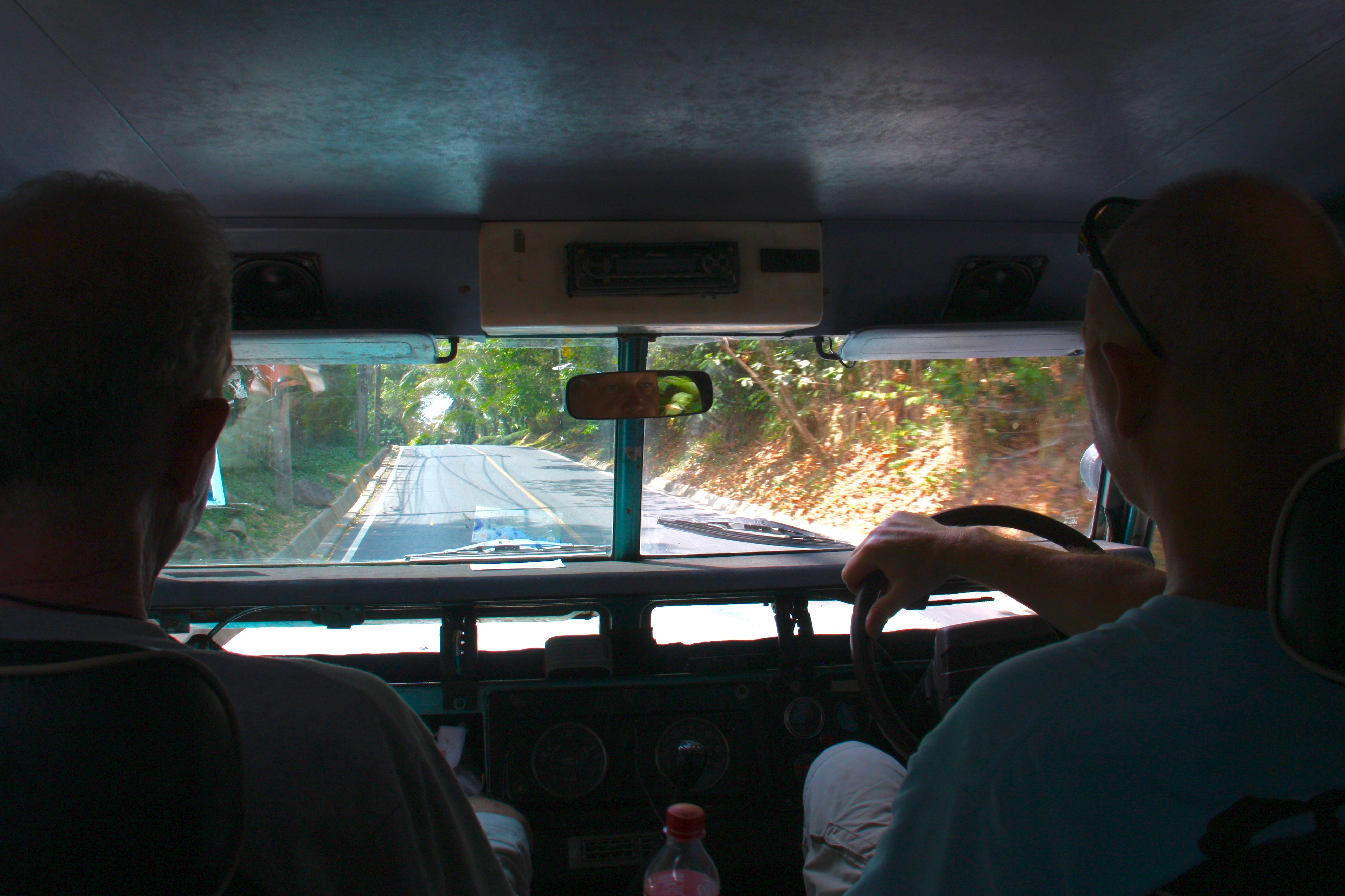
“Turn right here,” I shout at Torben, who is at the wheel. The roar of knobby tires on pavement, a throbbing diesel engine and all windows open for the fresh air — the air-con died within hours of starting the trip — robs our conversation of nuances.

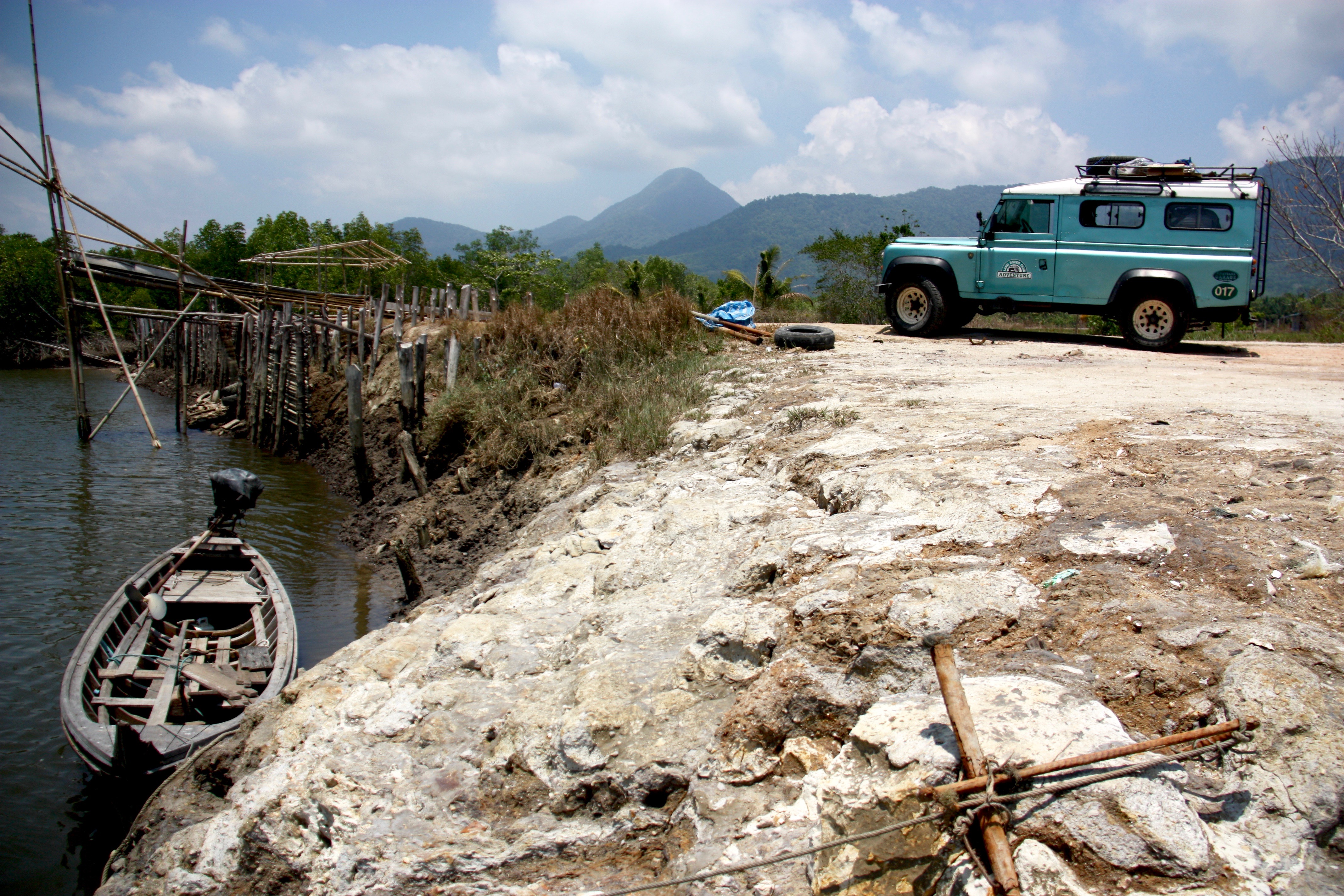
We jounce down a narrow dirt lane atop a dyke, with fish ponds on either side and no one else in sight.

“Where do you think this goes?” Torben asks, hunched over the wheel as he pumps the heavy clutch and drops a gear. The transmission gives a rattling snarl in reply.

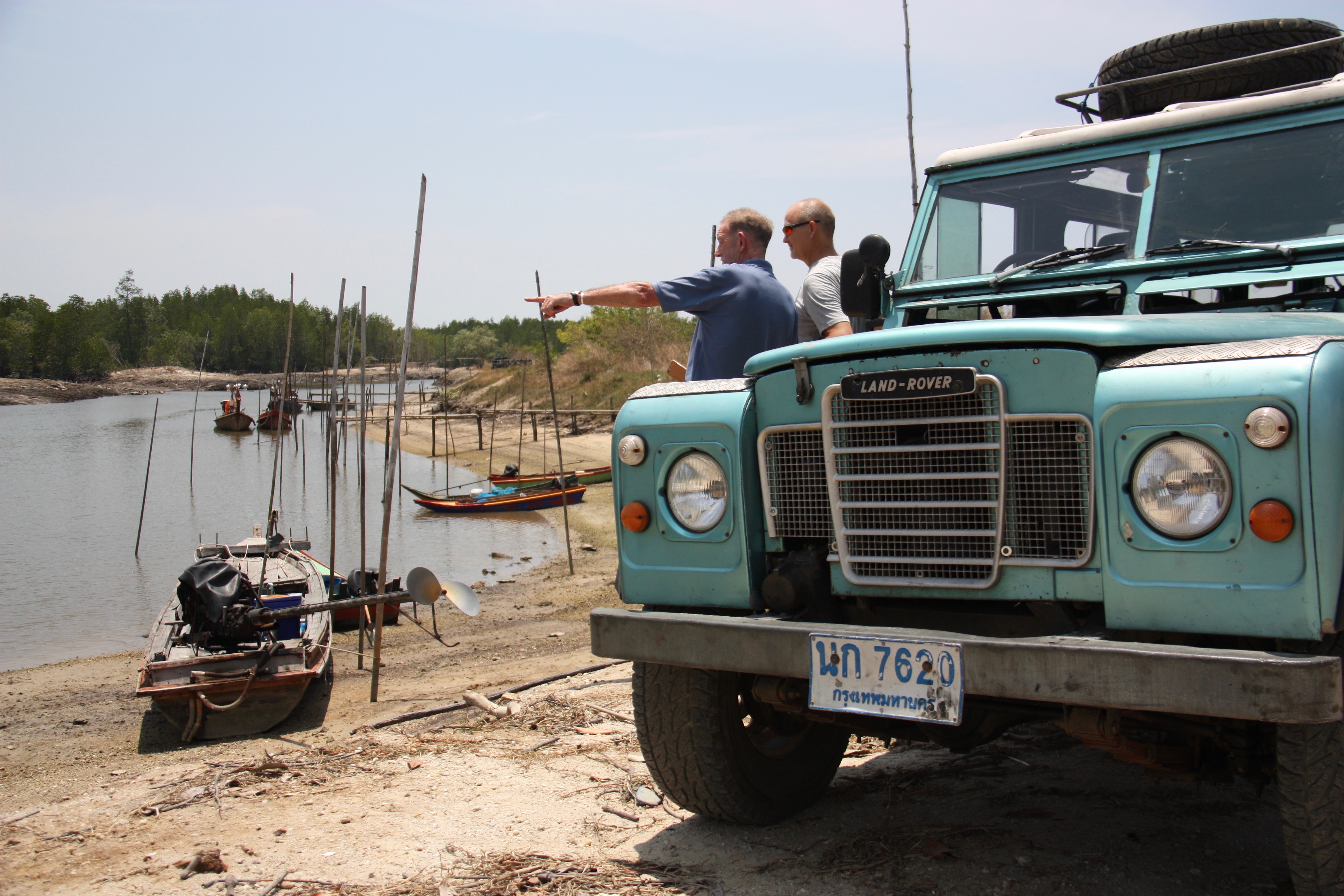
“I have no idea. Let’s see.” The road ends next to a strange loading chute that is built from bamboo. There is a creek, slow and muddy, and the stench of fish. We climb out of the truck for a closer inspection.

“We should have brought our fishing gear,” Johnny crows as we stand on the river bank, breathing in the humid air, heavy with heat and stillness. Thailand can get bloody hot at times.

cd-thailand-road-tripimg_2047

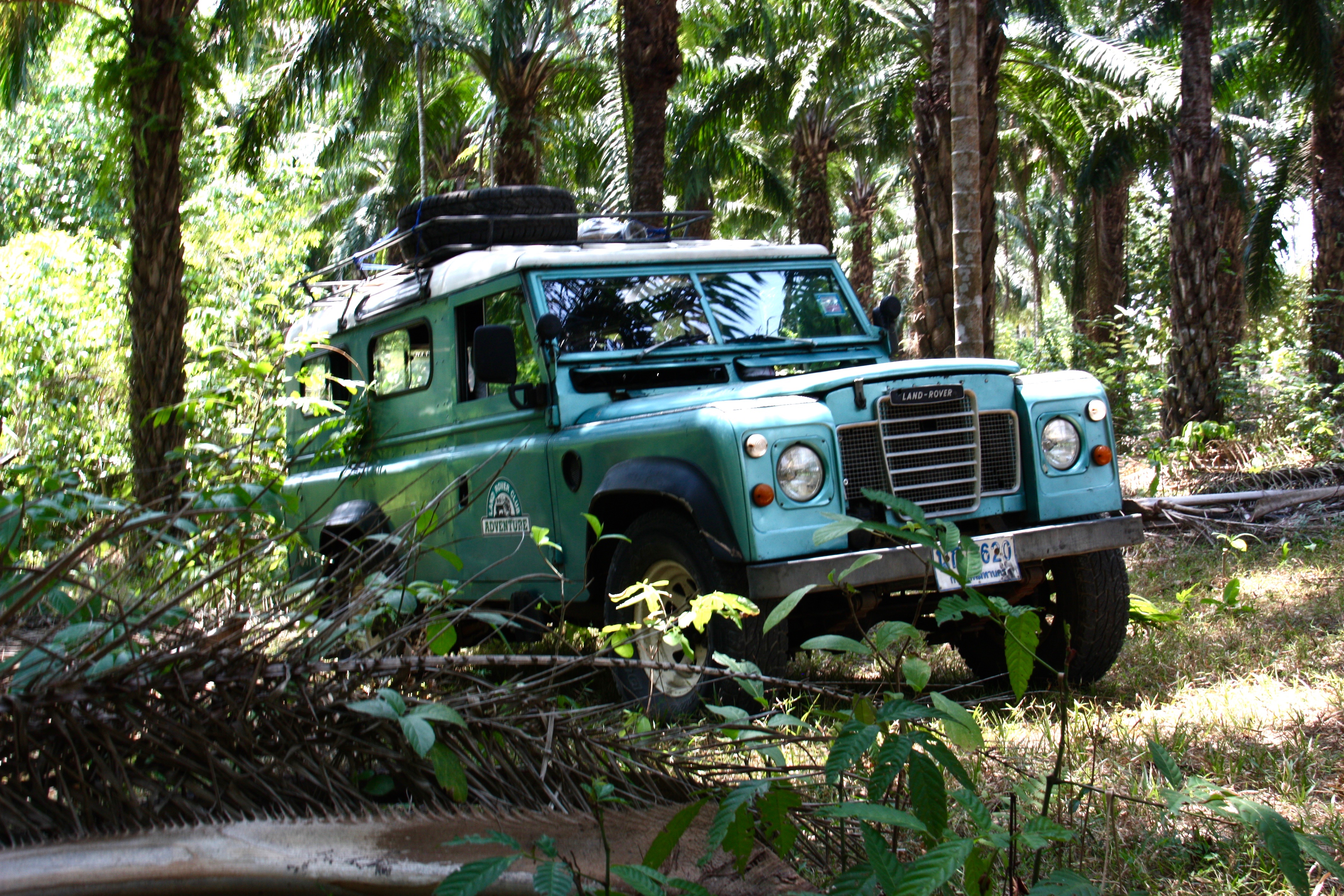
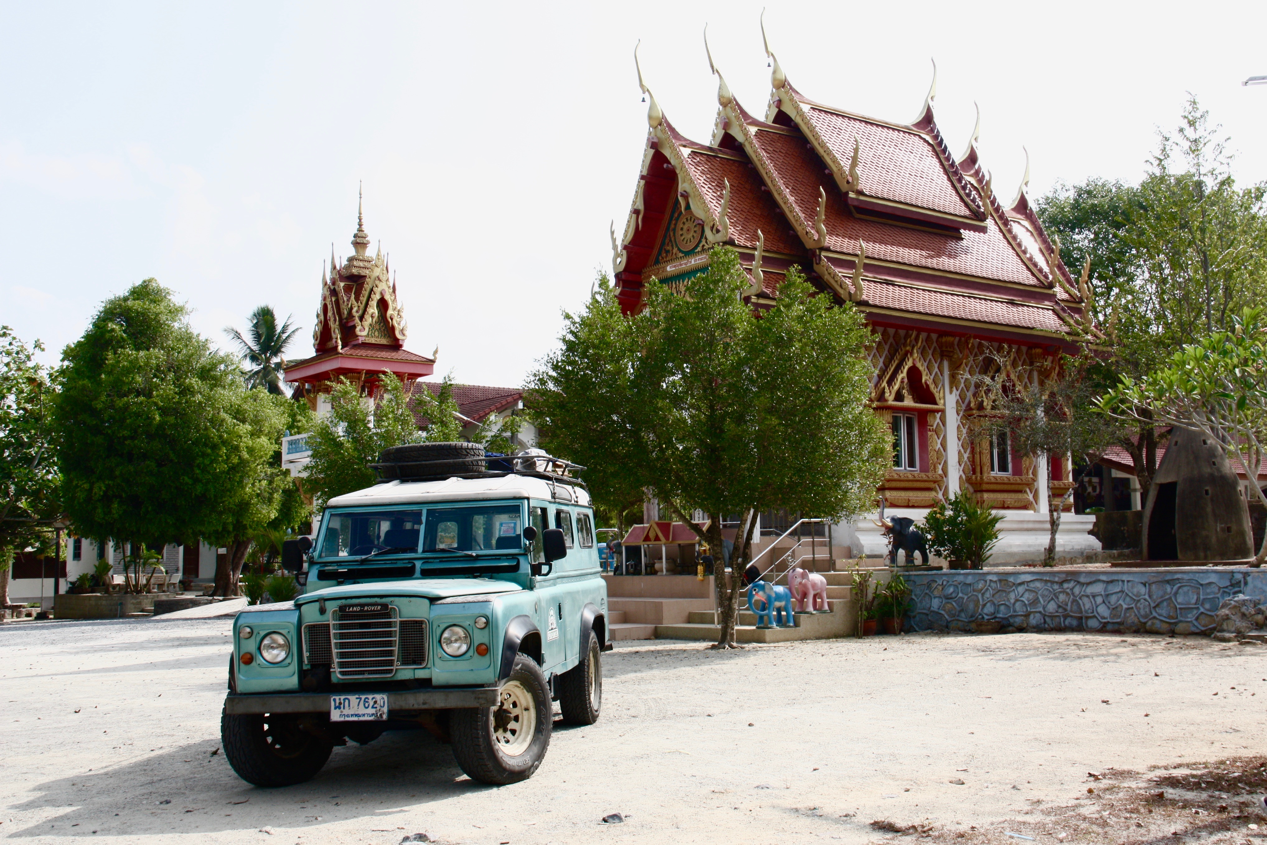
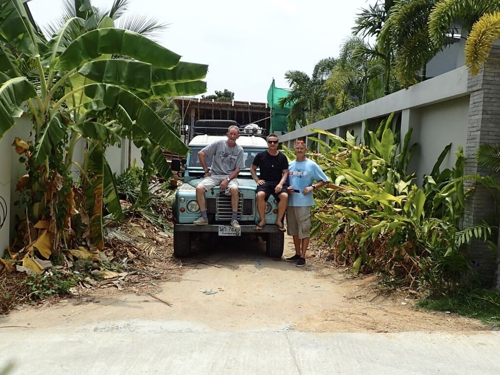
My friend Torben bought the 109 inch Land Rover Series IIA in Bangkok and needed to move it to Phuket. As soon as Johnny and I heard that, we replied, in unison, “Road trip!”

Torben had never driven this Land Rover any further than around the block, so it was with some apprehension that we flew from Hong Kong to Bangkok with return tickets leaving from the other end of the country, three days later.

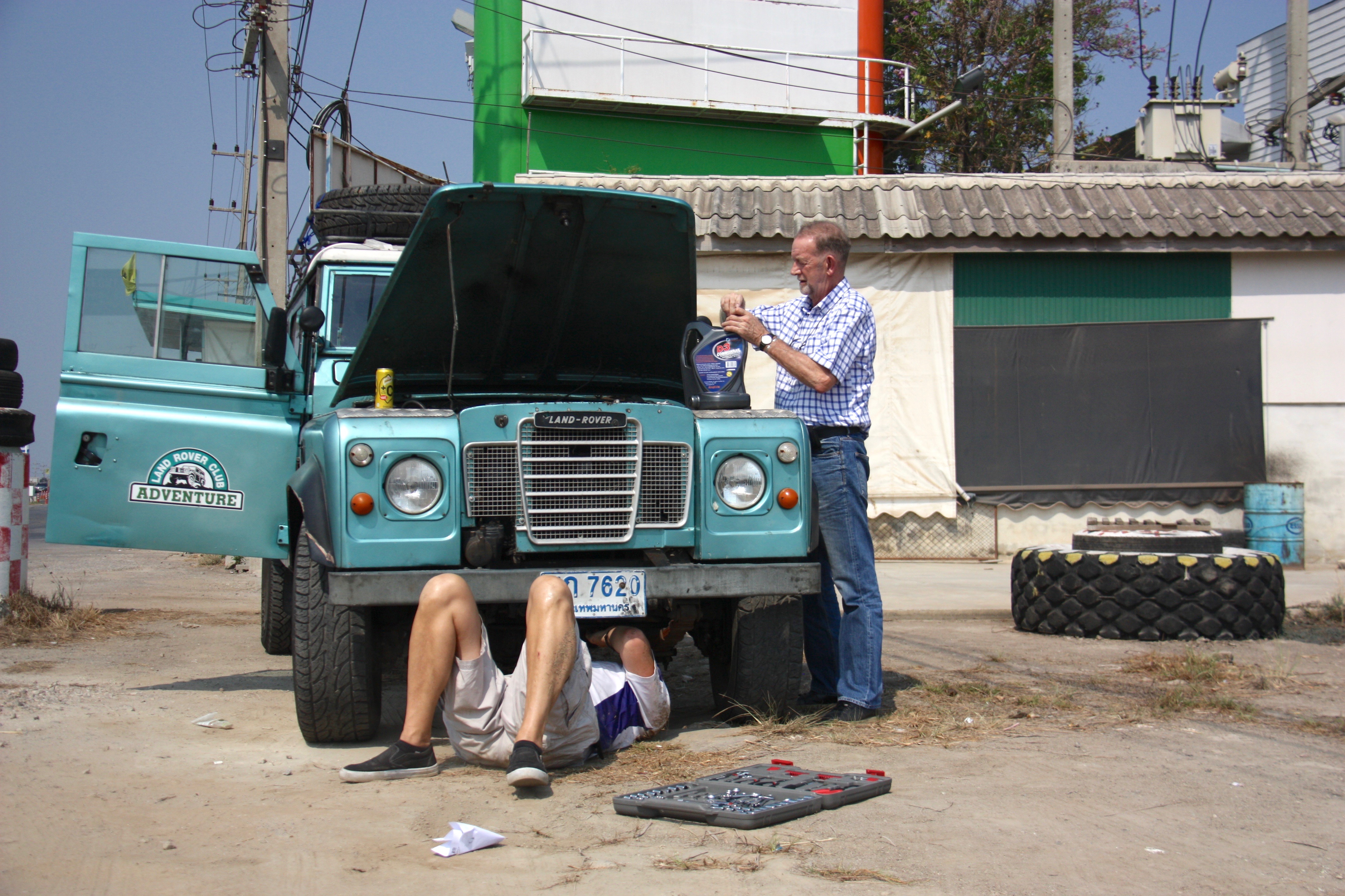
We weren’t clear of the Bangkok suburbs when we heard a strange rattling sound — broken bearings on the sleeper pulley for the belt driving the air-conditioner. While we were cutting the belt away — easier to get rid of the air conditioner than fix the pulley on the road — we spotted a steady drip of oil coming from the vacuum pump for the brake booster. Torben tightened the bolts a few grunts worth, topped up the oil and we cautiously set off again.

cd-thailand-road-tripimg_1886

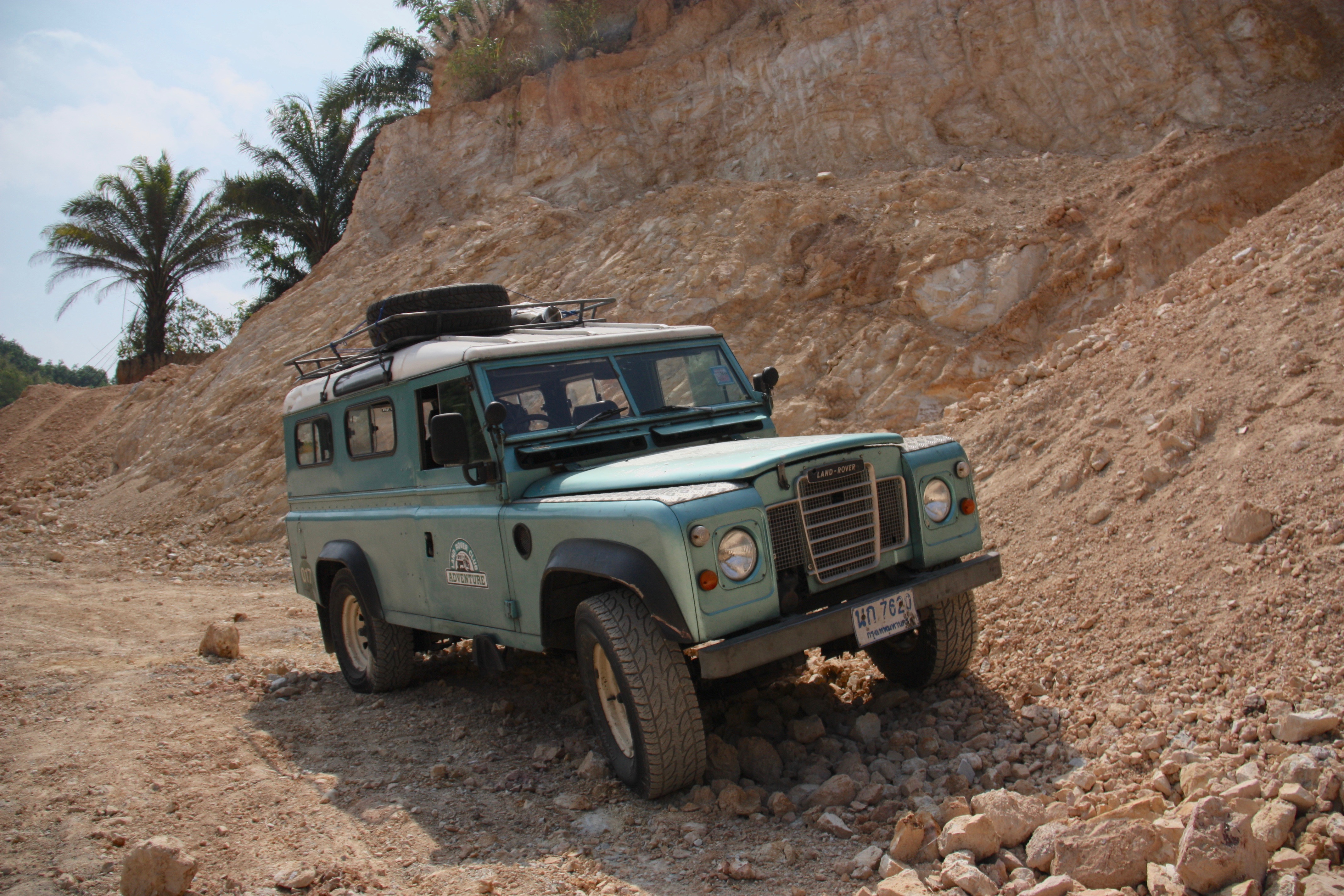
We were on Route 4, also known as Phetkasem Road, and Google Maps predicted the trip to Phuket would cover nearly 900 kilometres, taking 13 hours. That soon became unfeasible as we repeatedly turned down side roads that added distance and time but led us through villages and farm land and down to the sea. We stopped to buy mangos and pineapple at road side stalls and steered into gravel pits and palm oil plantations.

cd-thailand-road-tripimg_2021

cd-thailand-road-tripimg_2144

To be honest, I had no idea what a cross-country trip in a Series IIA would be like. I didn’t know that my neck would get stiff from slouching down to see out of the window. I didn’t know that I’d feel the bumps in the road with the top of my head. There was no way for me to understand that “let’s stop for coffee” really meant “it’s time to check the oil.” I didn’t know how it would bring smiles to the faces of the gas attendant and the guy who gave us directions late at night. I was a complete Land Rover novice.

The Land Rover was one of Torben’s fantasies. He imagined lazy days of hauling sandy kids to and from the beach, fetching lumber to complete his new home or bringing home a load of plants and gravel for the garden.

“I wanted something I could use, reliably, right away. But I also wanted something I could work on and improve,” he said.

cd-thailand-road-tripimg_2169

This truck was once owned by the owner of the Land Rover assembly plant in Thailand, where they used chassis from the UK to assemble vehicles. He sold it to the government, but his son bought it back. But then the son passed it on to a man who used it to haul a 3,000 kilogram trailer around Thailand, who sold it to Torben. Over the years, the suspension had been changed — very little improvement in my opinion — the now-defunct air-conditioning was added, along with a new alternator and an upgraded Salisbury rear axle and differential. The original engine had been swapped for a Nissan six cylinder turbo diesel, connected to a Nissan gearbox. The radiator had to be moved forward and the hood made longer to accommodate the in-line engine.

“It’s typically Land Rover but with power steering and much better seats, which gave it some luxury status,” said Johnny, who owned several 88 and 109 Series IIs in the UK over the years.

“But this seat back here is crap,” I said, pointing at my squashed legs and the puny backrest.

“That’s why I’m not sitting back there,” Johnny responded with a grin as he leaned back in his bucket seat.

Behind me was a jumble of luggage, tools and cans of oil, as well as an ice-box full of drinks. We were also carrying an extra front axle and prop shaft — when you buy an old vehicle you get the spare parts as well.

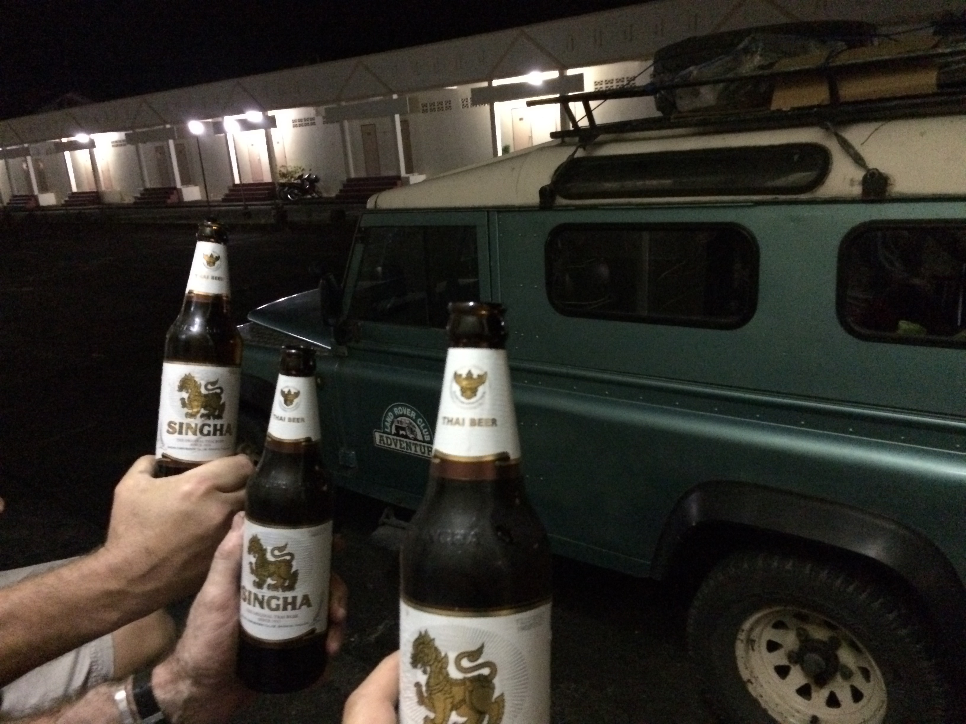
Every road trip needs at least one dodgy hotel, and ours came in Chumphon, a city surrounded by farms, right on the Gulf of Thailand. Our breakdown meant we arrived late, when the more reputable hotels were already full. What we were left with looked like a prison, with a harsh, faded facade and lumpy beds. There were no bars or restaurants in sight, so we sat on the concrete steps outside our rooms drinking beer from 1 L bottles, staring at the Land Rover parked in front of us.

cd-thailand-road-tripimg_4454

“We spent all day in that bloody thing, and now we’re sitting here, three blokes, staring at it while we’re drinking our beers,” Johnny said before going to his room. “I was hoping to find someone else to talk to besides just you guys.”

The next morning we drove west until we reached Kraburi river, which forms the border between Thailand and Myanmar on the Kra Isthmus of the Malay Peninsula. Myanmar was just a stone’s throw away on the other side of the narrow river. We followed the river south to its wide estuary, filled with thick mangrove forests, ending up in the gritty river town of Ranong for lunch.

Route 4 is peppered with waterfalls — beautiful when there’s water, but as we made our trip Thailand was in the midst of a drought, and the waterfalls were dry. But the temples were still there, as were the national parks and innumerable small roadside restaurants serving excellent food for cheap.

One of the best parts of a road trip is watching the landscape, culture and climate subtly change with the kilometres. Even with the drought, Thailand’s landscape became greener as we drove south. Soon the road began to climb up and down the seaside mountains. Mosques became more plentiful — about 30 percent of the population of Southern Thailand is Muslim — and the prominence of the ports and beaches showed the sea was the centre of everyday life.

cd-thailand-road-tripimg_2059

With the windows open we could also enjoy and suffer the smells as they changed. The loamy smell of elephant dung as we passed a sanctuary, the sharp tang of dried fish when we were near the sea and the smoke of burning fields in the farms of the river flats.

The three of us had all been to Thailand many times in our decades of living in Asia, but this was our first road trip, taking us to less-touristy parts of the country, where the Land Rover drew plenty of attention.

“The response we’re getting from the locals is different than I’ve experienced here before,” Johnny said as we climb back into the Land Rover after a fuel stop. The cheery young gas jockey was chatty and curious about our trip, waving goodbye as we pulled out of the service station. “I don’t think they see us as tourists, in the regular ATM sort of way.”

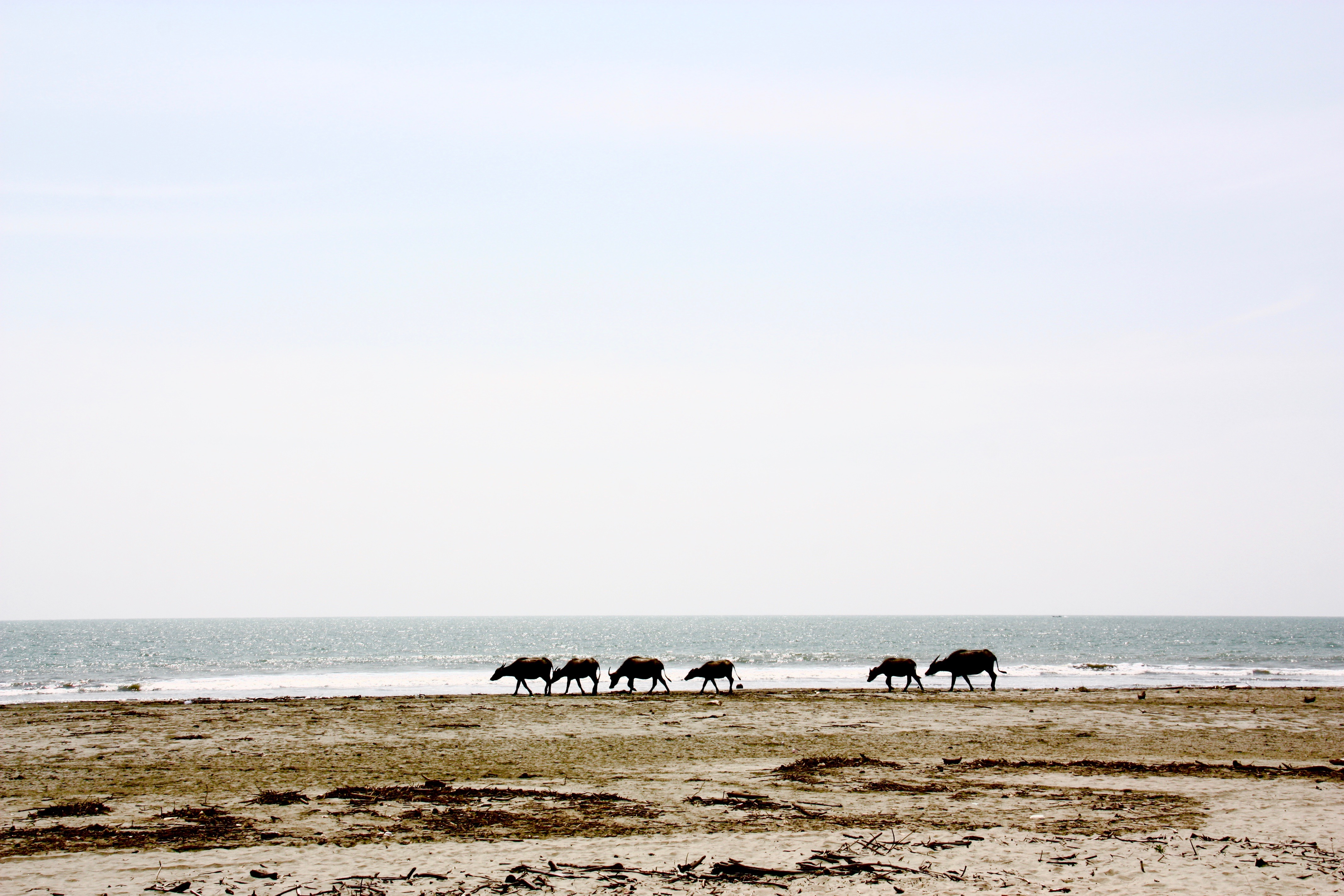
Another random turn off Route 4 took us through flat pasture land dotted with cattle and goats. It ended in a quiet, humble little seaside resort and camp ground with one Russian couple eating watermelon near the beach. Long-horned cattle wandered across the sun-baked beach.

cd-thailand-road-tripimg_2155

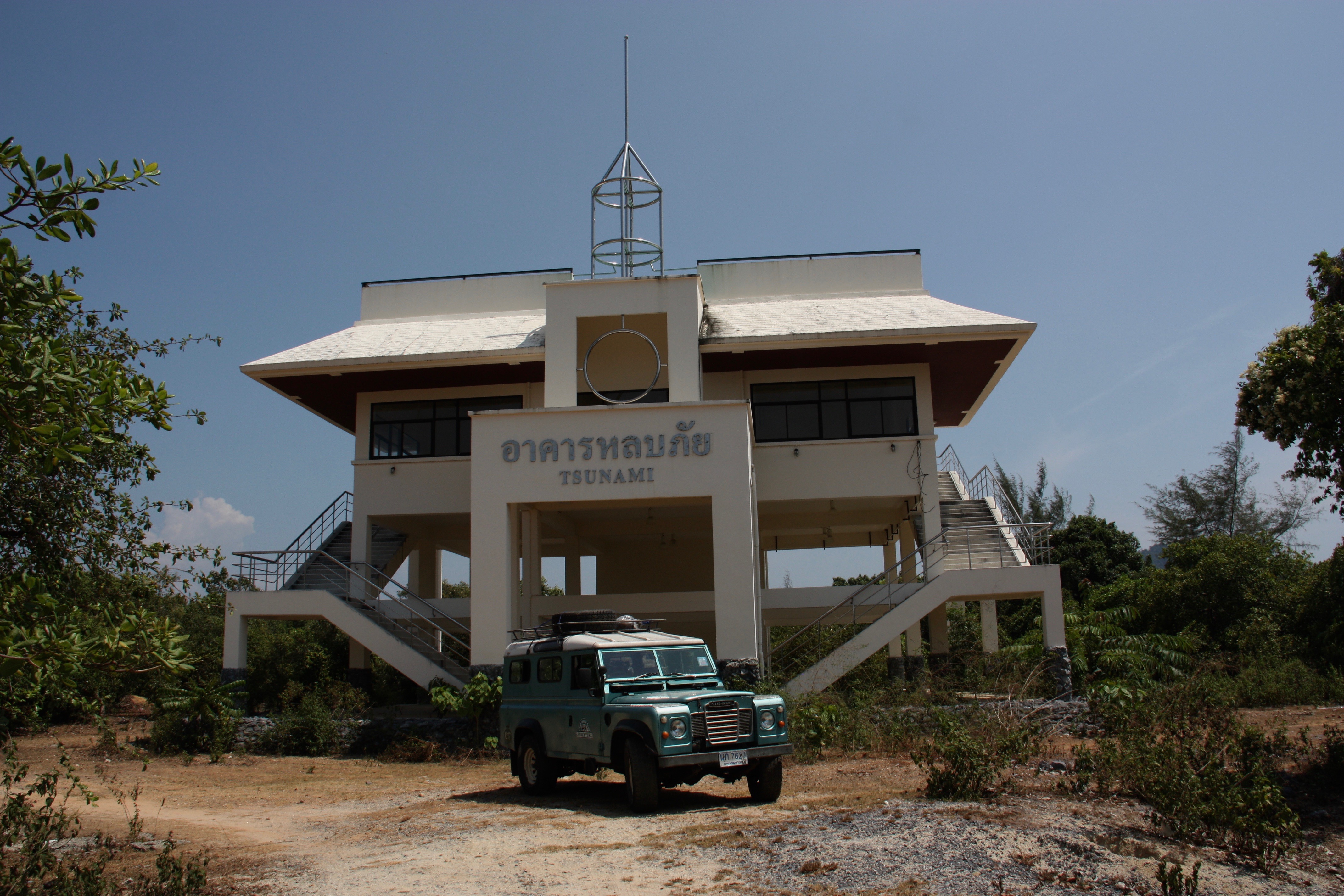
The same small road passed by a tall white building, open sided with wide steps — a tsunami shelter. Route 4 took us through some of the areas hardest hit by the 2004 tsunami. Seaside villages still showed unexpected gaps, barren lots and ruined buildings. Signs pointed to tsunami shelters and radars scanned the sea.

cd-thailand-road-tripimg_2146

Police Boat 813 in Khao Lak is a chilling memorial to the awesome natural strength of the catastrophe. The boat was guarding Her Royal Highness Ubonrat Rajakanya Siriwaddhana Phannawaddee and her family, who were staying in a beach resort, when the tsunami hit. The tsunami swept the 80-foot steel boat inland almost 2 kilometres, where it was deposited unceremoniously with no route back to the sea.

cd-thailand-road-tripimg_2165

We remained in the slow lane — the vibrations became too much above 80 km/hour — and cheered each time we overtook another vehicle. Still, we pushed the truck hard for a few hours to reach Khao Lak, a quiet resort town 60 kilometres north of Phuket. We wanted to arrive before sunset this time.

“We gotta stay somewhere nicer than last night,” Johnny said. “I want a good meal and cold beer.”

We arrived with enough time to check into our hotel — nicer, with a pool this time — pour ourselves rum and cokes and carry them down to the beach in time for a sunset swim.

Three days after starting out we crossed Thepkasattri Bridge, which connects mainland Thailand to Phuket. We parked the Land Rover outside Torben’s half-completed house with plenty of time to catch our flight back to Hong Kong.

“We made it!” Torben said. “I have to be honest, I didn’t think it would go that smoothly, or that it would be that fun.”

cd-thailand-road-tripimg_2231
Throughout the trip Torben had been scheming on the work he’d do to the Land Rover. The engine needed servicing, the prop shafts appeared to be bent and the brakes needed work. But beyond that his plans had slowly evolved as he got to know the vehicle’s character.

“I was going to fix it up and make it all pretty,” Torben said as we stood next to the Land Rover, waiting for our taxi to the airport. “I am not sure about that now. I have kind of fallen in love with its rugged and purposeful look. I’ll fix the mechanical stuff, give it a good clean inside and out and maybe repair the worst dents and scrapes but I won’t repaint it.”

“And then I’ll just enjoy it for being a Land Rover.”

cd-thailand-road-tripunspecified

Raja Ampat

Earlier this year I went on a kayak and dive adventure in Raja Ampat, Indonesia. Here is the story that ran in the SCMP, and a photo essay on the Canoe & Kayak website.

CD-RajaAmpat-IMG_0753

There’s the muffled rattle of floorboards as someone walks across the platform you’re living on. Parrots, hornbills and a score of other exotic birds chirp and trill overhead. There’s the hiss of waves hitting the shore and maybe the splash of fish. But other than that … silence.

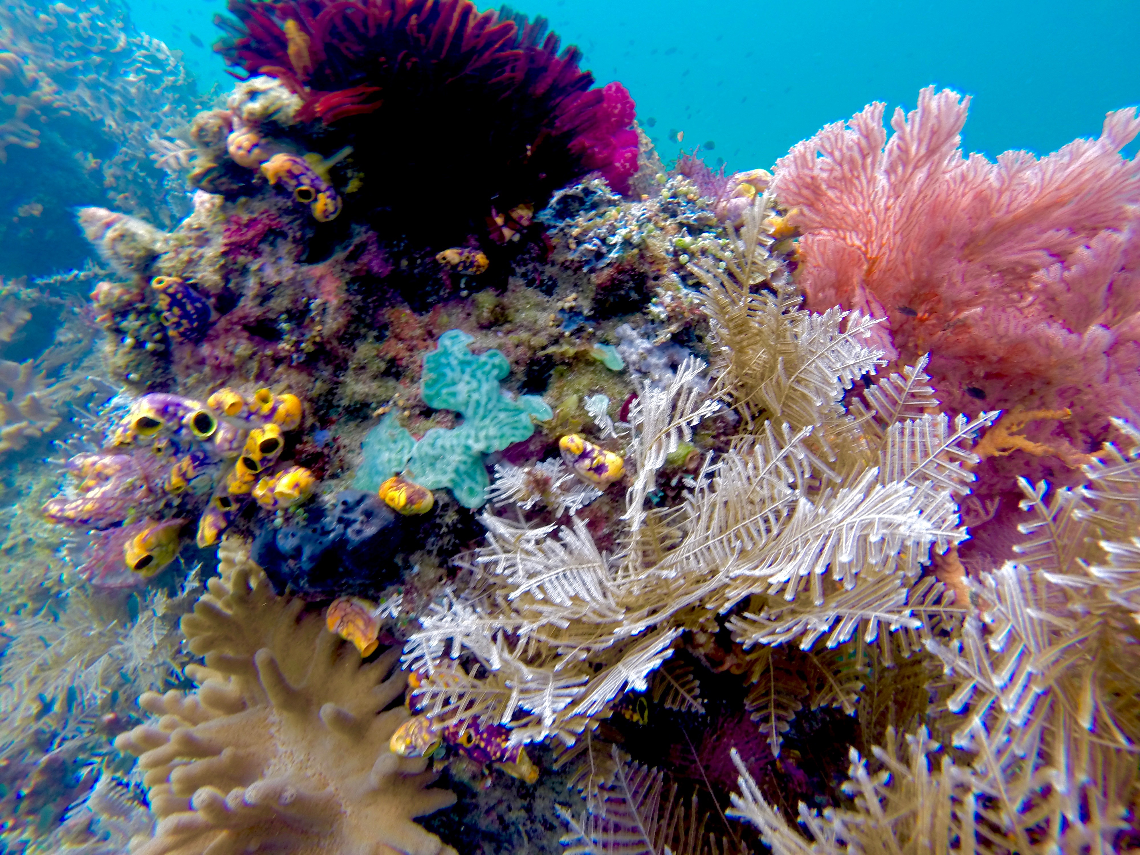
Raja Ampat, an archipelago in the Indonesian state of West Papua, is less densely populated than the Western Sahara, but this undeveloped, remote corner of Asia is home to the greatest diversity of marine life and coral reef ecosystems on Earth.

Scuba divers have been exploring this marine paradise for a few years and live-aboard dive boats are a common sight, but for land-based tourists, the region’s back-to-basics homestays are the best way to immerse oneself in Papuan life.

DCIM106GOPRO

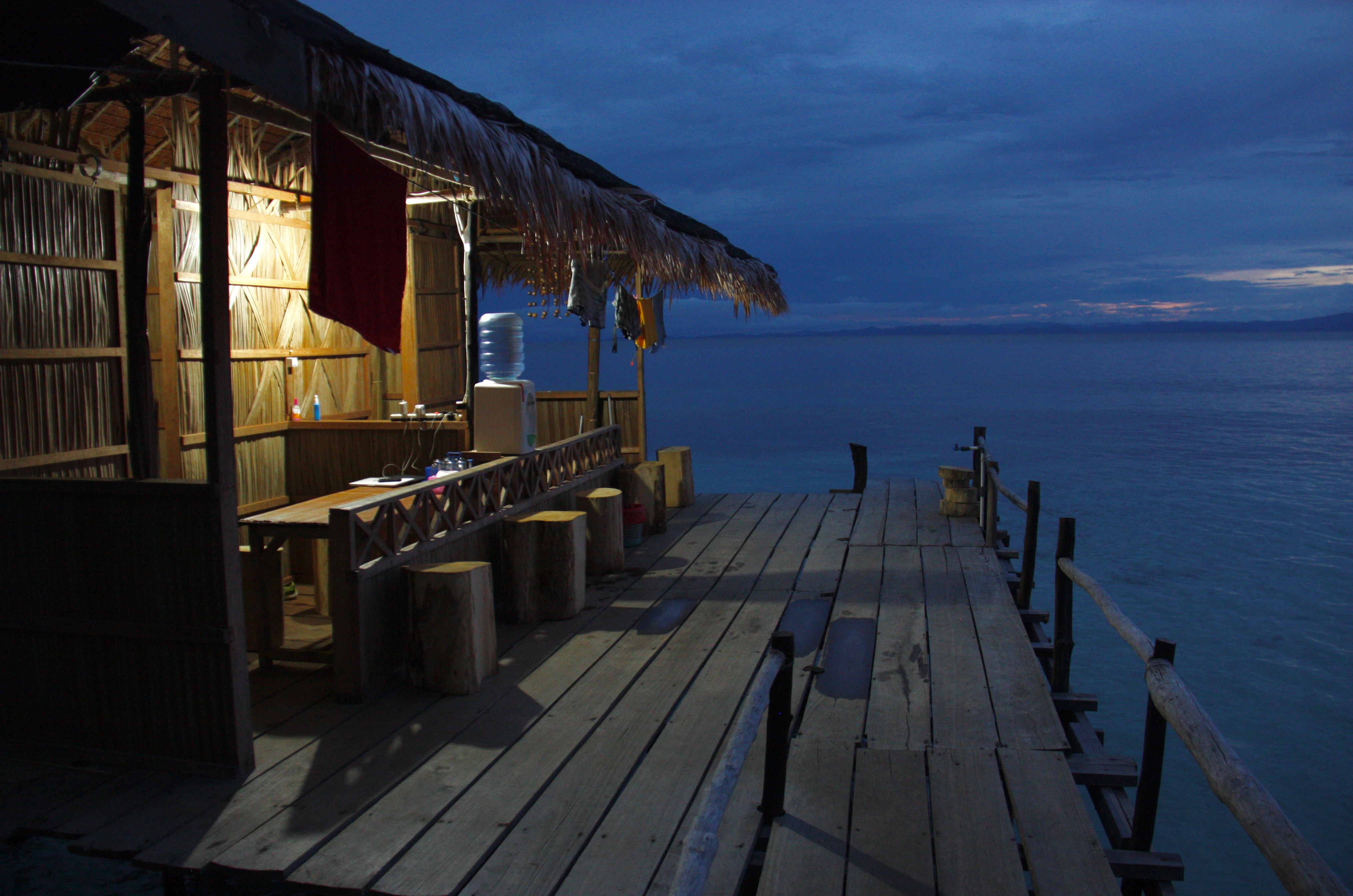
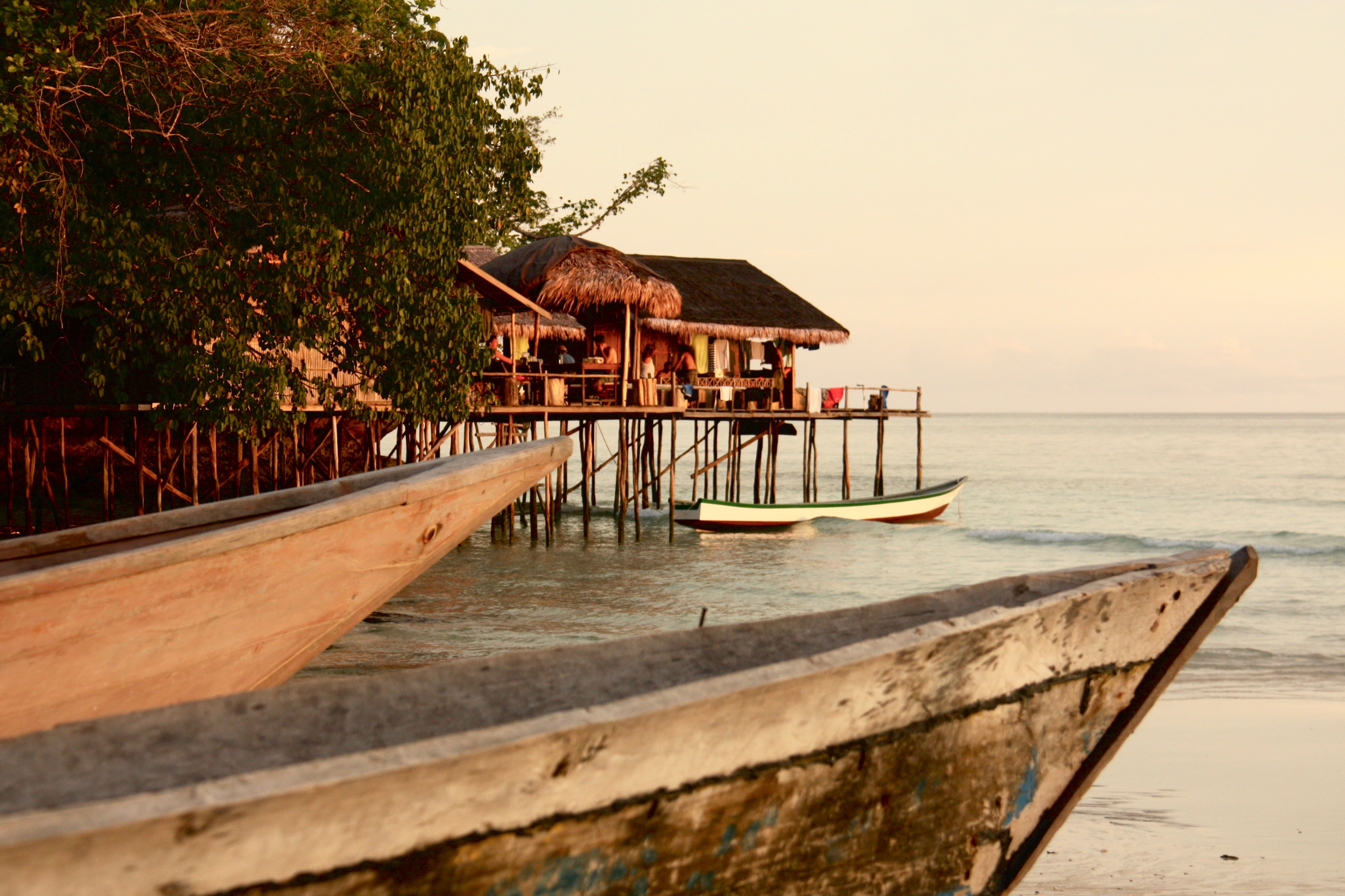
A 35-hour string of flights, ferry rides and car journeys from Hong Kong deposits us at Mando’s, a homestay built typically of bamboo and palm fronds on stilts over the sea. Home life in Papua takes place on wooden platforms, each having several rooms or huts on it, for cooking, eating and sleeping. As at most homestays, meals at Mando’s are served family style.

The dive industry here is largely operated by Indonesians from other parts of the country, but homestays are owned and operated by Papuan families. They form a bridge between the life on the sea that is so central to Papuan culture and the wild, forested islands that provide wood, food and fresh water.

Mando’s is on the main island of Waigeo and within driving distance of Waisai, the grimy little capital of Raja Ampat and the only place on the island where you can buy supplies. The views from the dining room – a table under a grass roof – make for disjointed conversations.

“So after that we caught a flight to … Oh look!” a traveller exclaims. Everyone around the table cranes their neck. “A school of dolphins.”

Or a jumping manta ray, a fish leaping from the water, a surfacing turtle, an exotic bird soaring across the sky. After a few days, dolphins are no longer newsworthy, and the challenge becomes catching sight of a leaping manta ray. All I ever see is the splash.

DCIM106GOPRO

Waigeo is home to the rare Wilson’s bird-of-paradise, a red and blue beauty that can be spotted on a morning hike in the jungle. At night, glow worms ( Odontosyllis enopla) flicker bright green in the sea as they pump out bioluminescence to attract a mate.

Many homestays are in remote locations and neighbours may be 20km down the coastline or across the open sea. Island hopping takes planning, patience and time. There is practically no scheduled inter-island transport and few of the islands have roads, making privately hired longboats the most convenient mode of travel.

Longboats also allow you to see the karst topography, and explore small islets so undercut by waves they look like mushrooms. We weave through the islands, staring down into the crystal-clear water at endless coral reefs, schools of colourful fish and small sharks.

DCIM106GOPRO

Raja Ampat’s coral reefs have shown greater resilience to the bleaching caused by rising sea temperatures than others around the world, and conservation efforts have greatly increased fish populations in the protected areas, but the flourishing marine life attracts poachers.

The Indonesian government has taken a strong stand against commercial fishing and created large protected areas, but this region is also rich in other natural resources. The largest gold mine and the third-largest copper mine in the world are nearby, and the Papua region is Indonesia’s largest source of tax revenue. That has attracted a large military presence, and many activists have disappeared, been killed or been jailed.

The Raja Ampat Research and Conservation Centre is one of the best established community development groups in the archipelago, and a key local partner of many international conservation organisations. The centre trains Papuans to build boats and then guide tourists on kayaking tours in those boats – the same development plan used for the homestays – provides research facilities and operates educational programmes.

“Our goal is to support those living in this beautiful and fragile ecosystem to have better, healthier lives and make them stewards in protecting this natural environment,” says Tertius Kammeyer, who heads the centre’s kayaking operations.

CD-RajaAmpat-IMG_1733

Tourism is growing rapidly and new homestays are popping up on every island, but outside of peak seasons, when domestic travellers come to Raja Ampat, there’s a good chance you’ll have one to yourself.

Time loses its meaning when you’re living in a grass hut. There are no clocks or timetables; meals are served when they are ready.

Circumnavigating the island of Gam makes for a pleasant three- or four-day trip by motorboat from Waisai. It is not one of the “regal” islands – Raja Ampat means “four kings” – but Gam is near the centre of the archipelago, and has plenty of small bays along its coast. On a clockwise trip around the island, a first night might be spent in Arborek Village, on a sandy spit of an island just off Gam.

CD-RajaAmpat-IMG_1557

In Arborek, there is a daily reminder of passing time; the village bell – an empty fuel canister – is rung at dawn, gently awakening the village from its slumber. After breakfast on the beach, we paddle to nearby Manta Sandy, a sandbar where mantas come to feed on plankton and allow fish to clean them of parasites. We slip on snorkel gear and drop into the water, and within moments mantas with wing spans of several metres appear out of the blue. Watching them glide effortlessly through the water makes our boat travel seem a lot less elegant.

Yet there is no other way to get to Warikef, an isolated homestay in a quiet bay near the Kaboei Passage, a narrow, winding stretch of water that separates Gam from Waigeo. Strong tidal currents in the passage offer divers and snorkellers an exhilarating underwater ride among the fish and coral fans.

CD-RajaAmpat-IMG_1323

Warikef backs onto a steep, forested cliff, just below a cave that supplies a steady stream of fresh water. The sea beneath the platform teems with life, and just because we’re not in the water, doesn’t mean we’re not considered part of a food chain. I feel a splash of water on my foot as an archerfish mistakes me for an insect and shoots a carefully aimed stream of water between the planks. A book left on the floor gets soaked as the fish make repeated attempts to capture it for lunch.

As the sun sets, the jungle surrounding Warikef falls silent and the glassy sea reflects the last light of the day. I can hear the muted voices of the host family chatting as they cook our dinner. There is the hiss of a gas stove and rattle of pots, the entire platform swaying gently as they move about.

The generator is broken, and the only light comes from a flickering oil lamp. I lay on the decking and watch the stars come out, forgetting for a moment that a less-tranquil world exists.

CD-RajaAmpat-IMG_0766

Palawan Kayak

This story originally appeared in the SCMP’s Post Magazine on May 10 as “Blazing Paddles”.

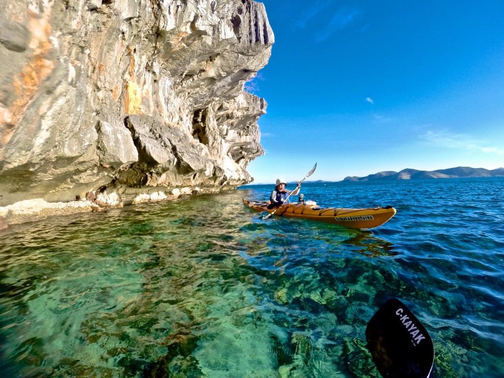
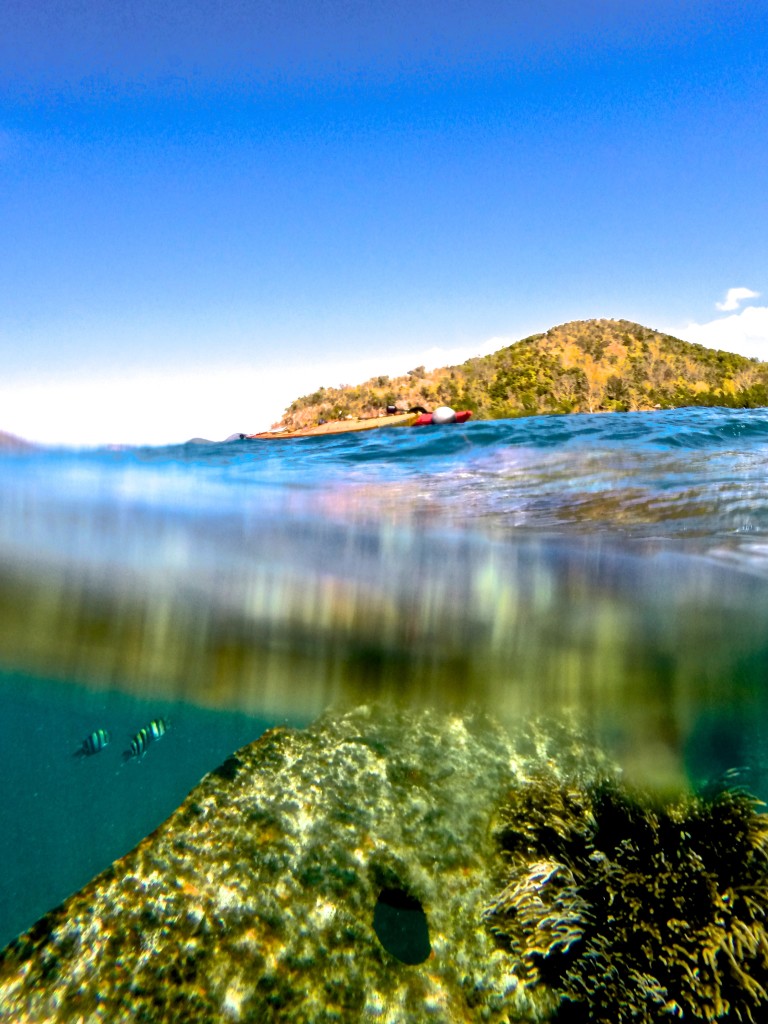
A wave of vertigo washes over me as I look down. It’s not far to the bottom – a few metres at most – but I feel as though I am floating in the air. The water is so clear, it is invisible, the sunlight brightening the colours of the starfish and coral on the sea bed.

Palawan is one of the most pristine and remote corners of the Philippines, and the country’s largest province by territory. Three of us are on a week-long kayaking tour, slowly winding our way through the karst islets and immaculate beaches surrounding Busuanga Island, in the northernmost part of the province.

Every paddle stroke brings into view another coral reef and another school of colourful fish flashing through the water beneath our hulls. The sky stretches achingly clear and blue overhead.

DCIM105GOPRO

From the cockpit of a kayak, Palawan is all rocky coves, distant rounded mountains and jagged cliffs with sugary beaches at their base.

It’s the end of the dry season, when the seas are relatively calm and the islands look parched. Other than a few fishing bankas – canoes with outriggers that come in a wide range of sizes – the only signs of human life are the occasional village and a few exclusive resorts huddled underneath palm trees on distant islands.

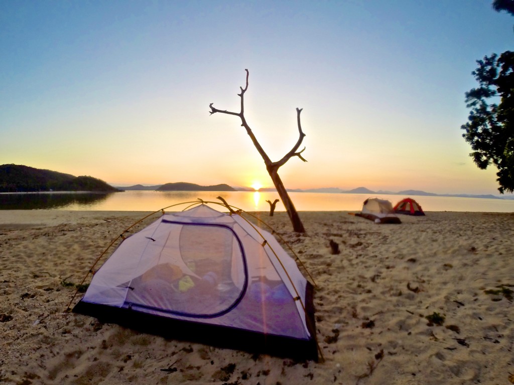
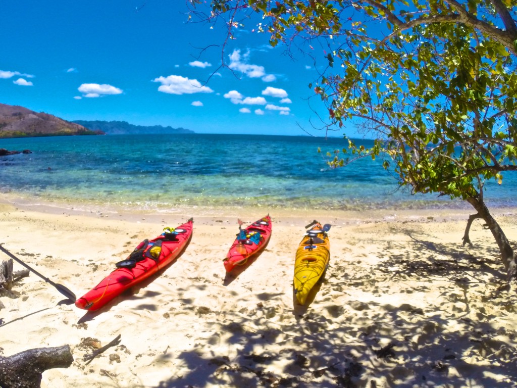
The sun has set by the time we arrive at our first campsite. We coast onto the beach, hulls scraping noisily against the sand, disrupting the evening silence. A nearly full moon casts the beach in a white glow, the curving trunks of palm trees standing out in stark relief.

From the kayak hatches come tents, cooking stoves, sleeping mats, bags of food and jugs of water. Many of the islands have no fresh water, so maintaining supplies is a constant concern. Tents are pitched and paddling gear hung up to dry. We cook an easy two-pot meal of pasta and vegetables, the air still so warm that working over the camp stove is uncomfortable. The fire we light on the beach is for cheer, and we sit well back from it in search of a cool breeze.

DCIM106GOPRO

Having awoken with the sun and after a quick breakfast, we’re back on the water, hoping to make the most of the cool morning air. We’re paddling north and, as we pass Lusong Island, one of our number lets out a shout.

“Hey, there’s something down there under the water!”

He is frantically back-paddling his kayak as he peers over the side. This region is littered with the wrecks of Japanese ships from the second world war, and we’ve just stumbled upon one. We tie our kayaks to a float bobbing on the surface, pull on masks and fins – stowed on the decks of our kayaks to explore reefs as we find them – and roll over the sides with a splash.

The wreck is in shallow water and filled with colourful fish that swarm around us, flitting away when we make sudden movements. The ship lies on its side, an entry wound of torn and twisted metal still evident despite heavy coral growth.

DCIM105GOPRO

For lunch, we land on a shady beach on Marily Island. It’s a pattern we’ll repeat in the days to come – an early start, followed by several hours of hiding from the blazing sun before we paddle on into the early evening.

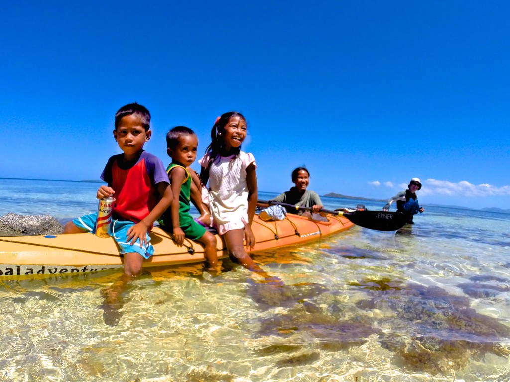
Many of the beaches and islands are inhabited only by caretakers, some with their families, who hold possession of the land for faraway owners. Some of them charge a few hundred pesos for camping privileges; others don’t even bother us to say hello.

“Isn’t it dangerous?” asks the caretaker of Marily Island of our trip, in English. “Where is your guide?”

We’re paddling sea-worthy kayaks, wearing personal floatation vests and special clothes to protect us from the sun. Our boats are filled with emergency satellite beacons, water filters and first-aid kits. We’re navigating by GPS and monitoring the weather on smartphones. The caretaker and his wife sleep in a house made of palm fronds and bamboo, and live a subsistence life. The assessment of risk is very subjective.

I have badgered every passing fisherman to sell me some of their catch, hoping for a beach barbecue, and I tell the caretaker about my fruitless search. He grins, jumps into his banka and paddles 100 metres off the beach. He dives into the water – once, twice – and returns with four fish.

“Here, these are for you. Now you can eat fish.”

I pressure him to take a few pesos and he finally relents, tucking the money into his waistband without looking at it. Then he climbs a tree, drops us three fresh, young coconuts filled with sweet, cool water, and goes off to fetch a bottle of wild honey that he has harvested in the hills behind his home. We offer him a bar of chocolate in exchange, thanking him for the food as well as the lesson in generosity.

DCIM106GOPRO

Several days into the journey the clear blue sky begins to show puffy white clouds and an ominous darkening far in the north. Super Typhoon Maysak has been slowly spinning its way towards the Philippines. We paddle to one of the larger villages, which has a mobile signal, to call our outfitter, Tribal Adventures. We are assured the typhoon has ebbed to a tropical storm and that it’s safe to continue our voyage.

I have become used to the fine layer of sea salt that covers my body and the reek of sweat, pungent in a sweltering kayak. Sand and salt have turned my hair into a wild forest, and my stubbled chin holds globs of day-old sunscreen.

DCIM105GOPRO

Each night we bathe in the sea, lolling in the warm water, bright moonlight making modesty impossible. Voices, singing indistinguishable songs, float across the water from villages that turn dark soon after sunset.

The inhabitants have no electricity; a few fires and torches shine and then wink out one by one while we still sit on the sand, eating our dinner.

Roosters announce the return of the villages each morning, as the sun slowly creeps above the edge of the sea, rousing us from our tents to pack up and resume our journey through this remote natural wonderland.

DCIM106GOPRO

Calauit Island

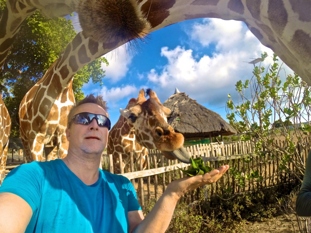
Calauit Island Game Preserve and Wildlife Sanctuary (calauitisland.com) is a surreal but delightful experience in one of the most remote corners of the Philippines. Giraffes and zebras that are thousands of miles from their natural home are free to roam the island, yet tame enough to pet and feed by hand.

The 3,700-hectare reserve, off the far northwestern coast of Busuanga Island, was created in 1976 by then Philippine president Ferdinand Marcos as a private playground. Closed to everyone but the Marcos family and visiting dignitaries until the 1980s, the park is now badly in need of funding and professional zoological staff. There is no veterinarian on staff to look after the animals and birds while the cages of some of the more dangerous creatures, such as crocodiles and snakes, are rusting. Many of the park’s outbuildings remain in ruins following Super Typhoon Haiyan, in 2013.

Still, that doesn’t take away from the magic of having a giraffe bend its elegant neck and reach out with its long tongue to pull leaves out of your hand, or waking up in the park campsite to see zebras grazing metres from where you lay.

Give your head a shake, you’re still in the Philippines.

DCIM106GOPRO

Seattle Screening on Feb 12

I’m very pleased that my documentary “The New Northwest Passage” will be screening at the Nordic Heritage Museum in Seattle, WA as part of their “Imaging the Arctic” exhibition.

Date: Thursday, February 12, 2015
Time: 7:00 pm
Location: Nordic Heritage Museum, 3014 NW 67th Street
Tickets are $5

RSVP at documentary-newnorthwestpassage.eventbrite.com

FjordLobbysmall

Penghu

This story originally appeared in the SCMP’s Post Magazine as “The wind and the waves” on November 16, 2014.

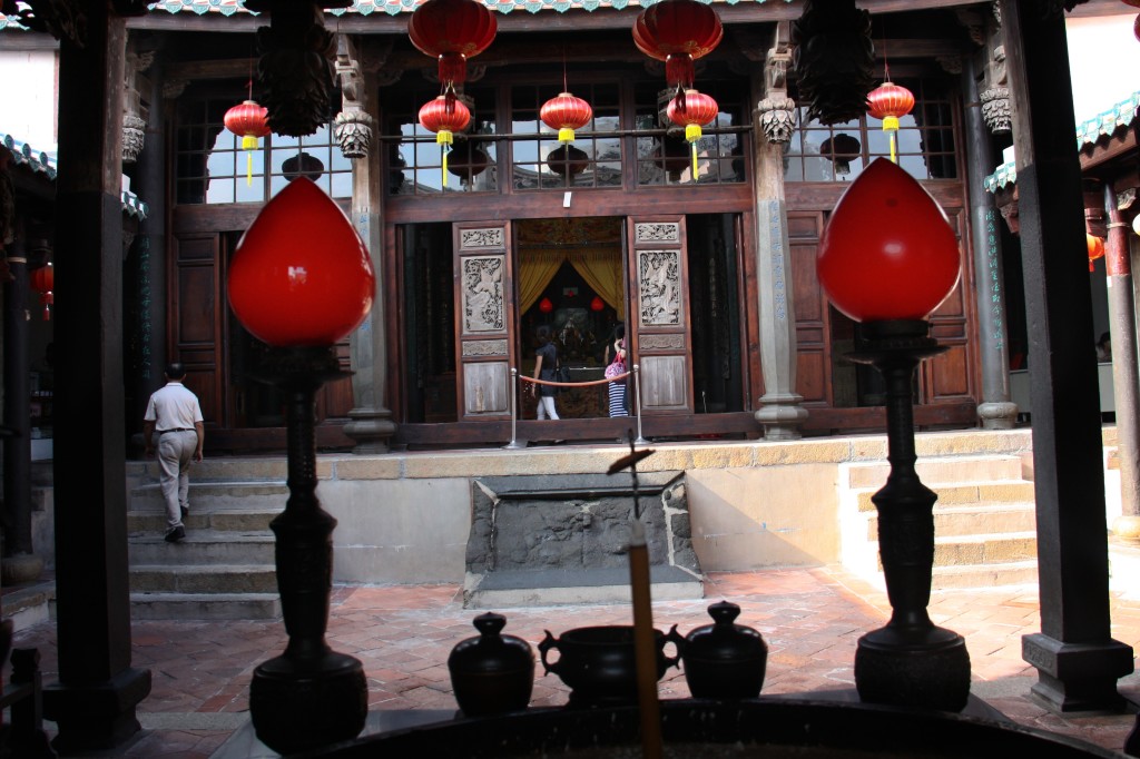
The temple is filled with the fug of incense, the air musty with 400 years worth of prayers that have been offered up towards its wooden beams. I’m not a religious man, and certainly not one who prays to Chinese gods, but these are special circumstances. If it worked for pirates, it might work for me.

Outside, the tangy brine fills my nostrils and the unrelenting wind tugs at my hair. I stand at the threshold, the darkness of the temple behind me, the sea just a few blocks away, knowing that thousands of sailors have stood in this spot, like me, wishing the winds would back off a little.

CD-PenghuTaiwan 273

From the Penghu Mazu Temple, the goddess of the sea, known as Tin Hau in Cantonese, has watched over this Taiwanese archipelago’s seafarers for four centuries, offering her protection from countless typhoons like the one that is now darkening the skies.

I came to notoriously windy Penghu, an archipelago of 90 islands, to experience its maritime culture and soak in the folklore of pirates and conquering navies. Now I’m experiencing the uncertainty of being a Taiwan Strait sailor. Penghu’s mariners learned long ago that the winds are out of their control, hence the 183 temples scattered across the islands, some large and grand, others so small and nondescript they’re hard to find.

Severe Tropical Storm Fung-wong is churning her way north, aimed squarely at Taiwan. As soon as my flight touched down in Magong, the islands’ main town, my skipper called to warn me that our sailing trip would be delayed.

Like any restless shore-bound sailor, I seek ways to kill time.

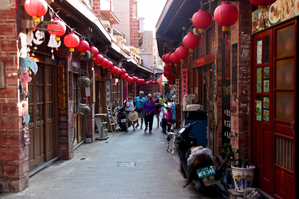
Magong is a maze of criss-crossing streets, the heart of the old town lying low and grey behind ancient walls, huddled against the elements. New, garish hotels and empty boulevards sit exposed to the steady rush of wind. The town’s bars have been shut down for the season, and I haven’t spotted any bordellos around the port, so I rent a scooter and ride the island’s winding roads.

CD-PenghuTaiwan 288

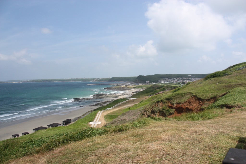
The reliance of the Penghu Islands, also known as the Pescadores, on the ocean is evident at every turn; from ancient houses and garden walls built of greying coral to the waft of drying fish.

Settlement of these islands began some 700 years ago, 400 years before the Chinese arrived on the Taiwanese mainland, and they served as a way station for people migrating from Fujian province to Taiwan, leaving the chain scattered with historical sites.

Numerous navies have anchored off the Penghu shores, their colonial forces engulfing the islands and then receding again, like the storms that sweep over the low-lying land. The Dutch came to Taiwan in 1624, were challenged by the Spanish and were eventually dislodged by Ming-dynasty loyalist Zheng Chenggong, whose Latinised name was Koxinga.

He was a privateer with a vast fleet and control over large swathes of China’s coastline, and the Penghu Islands were a frequent hideout. Koxinga used Taiwan as a base in his failed fight to overthrow the Qing dynasty and restore the Ming.

Eventually, the French came and built a fort overlooking Magong, but their stay was short, and they were long gone by the time the Japanese moved in for a 50-year stay, only to be replaced by the Chinese Nationalists.

CD-PenghuTaiwan 296

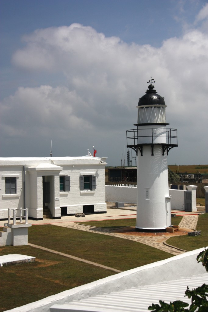
Now it is the Republic of China’s armed forces who are stationed on a far-flung promontory, their base built around the stately Yuwengdao Lighthouse, which was designed by a British engineer for the Chinese imperial government in 1828. Soldiers peer from behind rusted gates and banks of sagging sand bags, the camouflage paint on the buildings peeling in the sun. They slouch with boredom, staring across the strait at an ideological enemy that batters the island with tourists instead of artillery shells.

The islands have long been viewed as a frontline in tensions with mainland China, and martial law was only lifted in 1979, allowing people from Taiwan proper unfettered access for the first time. Penghu has since tried to grow a tourism industry, to prop up its tepid economy, offering as enticement its long, pristine beaches and azure water.

On July 23, Magong hit the front pages of newspapers when TransAsia Airways Flight 222, from Kaohsiung, crashed when landing in heavy winds and careened into nearby homes, killing all but 10 of its 58 passengers and crew.

“They were almost all from here, from Penghu, so it was very bad. Everyone knew someone affected,” says my host, Tom Chen, proprietor of the oddly named 1,2,3 V-Stone B&B, which is located a short walk from the main harbour and a five-minute drive from the centre of Magong, in a rapidly developing part of town.

“Now everyone is scared, so with this storm there will be no flights or ferries until it is gone.”

CD-PenghuTaiwan 312

The snaking road that connects the islands via bridges and causeways leads to Wai-an, in Siyu township, a small village perched in front of a hill that threatens to push it into the sea. The village is centred on its port, the main street tracing a line of bollards on the wharf and each side street leading to and from the water.

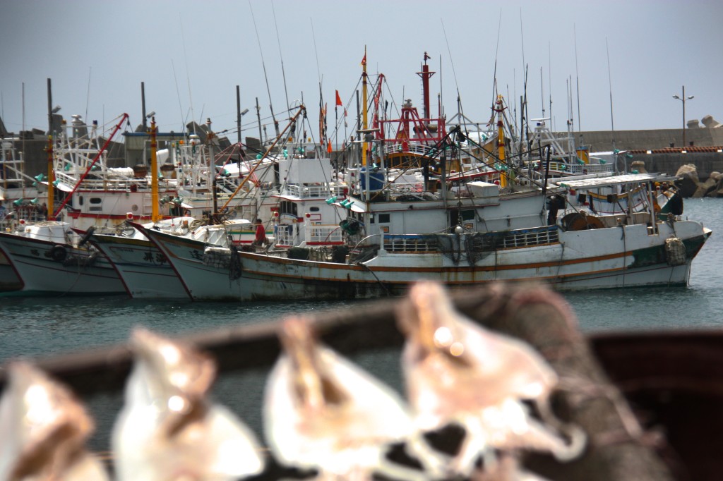
The harbour is jammed with fishing boats, with more arriving every hour, seeking shelter from the impending storm. The boats appear first as dots on the horizon, riding a white wake as they draw near. They rumble into the port and tie up three deep along the wharf, where fishermen sleep in hammocks or squat on their haunches, cigarettes smouldering between their lips as they repair their nets.

CD-PenghuTaiwan 306

“Looks bad, doesn’t it,” I ask a group of fishermen sitting on the wharf, surrounded by billowing heaps of net. They squint, looking up at the sky, where the sun still shines despite the dark bruise on the southern horizon.

“It will be over tomorrow,” they assure me. “The storm comes one day and then it is gone.”

The wind may prove inconvenient at times, but it does draw tourists to Penghu, whether for windsurfing, kite boarding or, more recently, sailing; the Penghu Regatta Week is held every June.

The fishermen were wrong, being out by two days, but finally the weather breaks, the wind dies and the skies clear.

We slip the lines on our 40-foot catamaran and motor to the harbour master’s station, to officially clear port before heading out to sea. A stream of fishing boats floods out of the harbour alongside us, crews eager to lower their nets.

Soon we’re making our way down the coast, where the ornate, curved roofs of the temples stand high above village houses. From the sea I can’t be sure which of the temples venerate Mazu, so instead I mouth a prayer of thanks into the breeze, sure that it will eventually reach the goddess of the sea.

DCIM103GOPRO

Manigotagan

This story originally appeared in SCMP’s Post Magazine as “Canoeing along Canada’s Manigotagan River” on Feb 1, 2015.

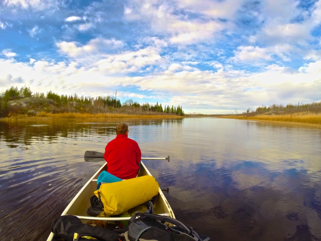
I am still trying to get comfortable in my seat and come to terms with steering the canoe when my brother points to the sky. A bald eagle with a two-metre wingspan soars overhead, its brilliant white head twisting back and forth in search of prey.

The eagle circles us in a lazy loop and then, with two smooth strokes of its wings, disappears over the treetops. When I come back down to earth, I find that our canoe is drifting down the Manigotagan River sideways – which is bad news, because it’s getting dark and we have yet to find a campsite.

The Manigotagan is only a few hours north of Winnipeg, the capital of Manitoba province. But we could just as well be a thousand miles from civilisation as the river carries us through the Canadian Shield, the massive rock craton that forms the core of the North American continent. This is rolling land with rock outcrops that were rounded off by the last ice age, leaving room for boreal forests and marshes. Maps show long, narrow lakes, all running in the same direction, torn into the earth by the slow claw of ice.

DCIM104GOPRO

Atop each rocky outcrop, at every roaring waterfall or quiet bend where the river slows, history invites us to imagine. To envision humans on this river thousands of years ago, proud natives traversing their land; the first European fur traders and voyageurs, men who came searching for their fortunes in Canada’s wilderness, toiling their way up and down this watery highway.

A nearby archaeological site proves that human habitation of the Manigotagan area began at least 2,000 years ago and use intensified when aboriginal people underwent a cultural shift from relying on grassland hunting to life in the forest, where they survived on fish, small mammals, waterfowl and wild rice.

When white men discovered the forests’ bounty, they set up the Bad Throat fur-trading post at the mouth of the river, on the eastern shores of Lake Winnipeg. The river became an important trade route for trappers and their canoes, and they were soon followed by loggers and miners. Rusting iron machinery, empty trappers’ cabins, shards of pottery and tent circles all mark chapters in this river’s history.

That trading post has become the town of Manigotagan, which continues to rely on nature, with forestry, commercial fishing, wild rice harvesting and tourism being the economic mainstays. The river is now travelled by weekend canoeists looking to connect with nature. The longest canoe trips stretch to 102km – five to seven days of paddling – and the last 70km of the downriver journey has no exits. After 32km, you’re committed to a week-long journey.

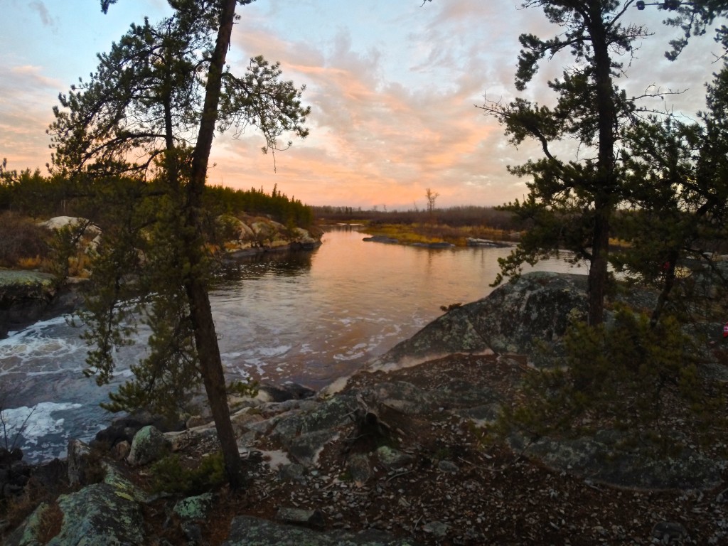
We start at the mouth and work our way upstream. Just as daylight begins to fade, we come to a thundering set of waterfalls. There are dozens of falls and rapids along the river, most of which must be skirted. This requires us to unload both two-man canoes and carry everything on forest paths that pass the dangerous water: a process called portaging.

At Old Woman’s Falls, the river appears to be trying to dislodge a small island. The water sweeps around the rocky obstruction before roaring into narrow chutes on either side.

DCIM103GOPRO

We gingerly land our canoes in eddies only metres from the maelstrom and drag them up to safety before scouting out a campsite. The island is one of the most popular campsites on the river but it is late in the year and no one else is braving the chilly weather. Or perhaps the ghost of the old woman whose death here gave the falls their name has scared them away.

Firewood collected and tent erected, we are soon sitting around a crackling campfire with dinner simmering in a pot. A few streaks of light remain in the sky and the falls are now just a flash of white in the dusk, a steady clamour of water bashing itself against the rocks.

The topography along the Manigotagan ranges from sheer rock faces topped with craggy Jack pine and a thin skin of rock-tripe lichen to thick green stands of balsam poplar, green ash and elderberry. Our small island is covered in towering pines, the reflection of the river glinting through gaps between the trunks.

And there is wildlife; the entire river lies within protected parkland filled with, among other creatures, moose, black bear, wolf and woodland caribou. Beavers can be seen working along the banks.

We sit, passing a rum bottle in circles, until we have depleted our wood pile and the fire fades. We give the dishes a hurried scrub in the frigid water, the clattering of pots echoing across the river. We crawl into our tent, hoping that whatever the large brown furry thing we saw earlier was, it won’t be brave enough to swim across Old Woman’s Falls.

DCIM103GOPRO

The next day, we continue upriver, leaving the campsite set for our return. We spend the morning paddling over gentle rapids. At midday we find a rock outcrop overlooking Big Skunk Rapids. The others gather wood while I mix up a batch of bannock, the simple flat-bread that is the traditional mainstay of native American cooking. We crouch around the fire, watching the dough turn a golden brown flecked with ash.

After lunch, we turn back, now riding with the current. My other brother, in the second canoe with his son, eyes up a low set of rapids that we portaged around earlier.

“I think we can run those, eh?” he says, as much a challenge as a question.

His canoe slips into the current, dips, bobs, is caught in a spray of water, as we hold our position in an eddy. I can see only heads.

A few moments later, a drenched duo are treading water, one at each end of the swamped canoe, gasping with shock at the cold.

“Get your canoe around the rapids and get us out of the water! Hurry!”

DCIM104GOPRO

We do as we’re told, less careful about the canoe’s paint than we were on earlier portages. The pair roll into our canoe, sodden and shivering, rocking the craft until I worry that we will all be swimming soon.

Back at Old Woman’s Falls, a fire leaping through the grating and clothing strung from the trees, the story is retold with added flourishes, a gentle nip of warning from nature.

The next day we break camp and turn for home, letting the current slowly pull us towards Lake Winnipeg. The sun breaks through the clouds and remains free, bringing out the blue reflection of the sky on the water, the emerald green of trees and moss.

As we approach our landing spot, where pick-up truck, mobile phones and cluttered life await, what looks like the same bald eagle takes flight out of a poplar tree along the banks.

Once again it circles and eyes us, as if tallying to check whether those who ventured into his hunting grounds have returned alive.

Himalaya

I went trekking in the Indian Himalaya in June. Here’s the long version of the story that ran in the SCMP Post Magazine this Sunday, on the web, and the pdf file.
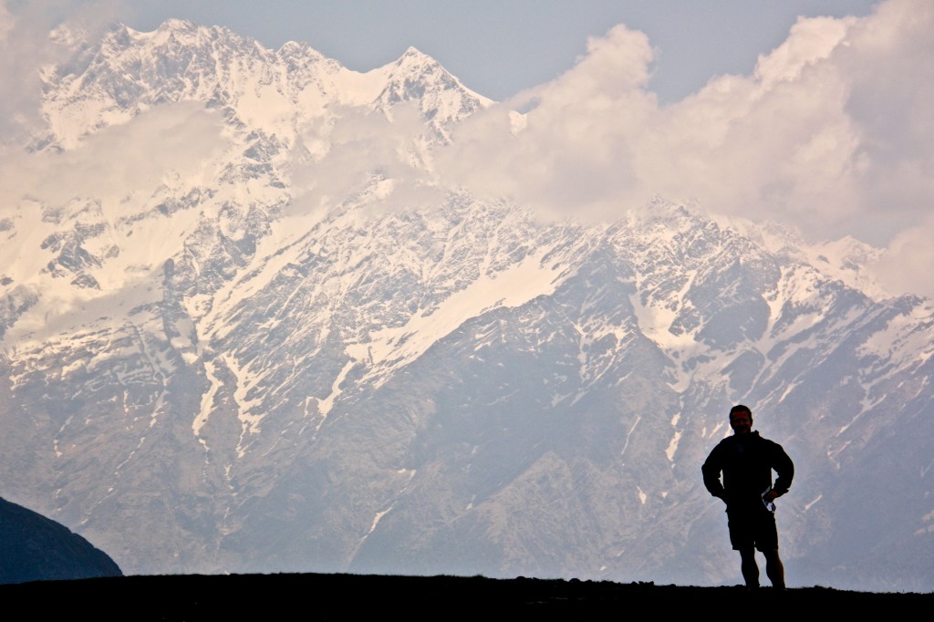
CDIndiaTrek 062

The camp is stirring to life. I’ve opened my eyes, once, briefly, to confirm that it is daylight. Now I nestle down into my sleeping bag, savouring its warmth as I wait for that magical moment that reminds me that this isn’t just another camping trip.

“Sir…Sir, good morning,” a soft voice says outside my tent. “Your chai is ready.”

The tent opens with a zzzzip and rustle of nylon, and there stand Gaurav and Saurav, two teenage brothers working as the cook’s assistants. They hand me a cup of steaming hot chai, which I take into my tent before zipping the door closed.

We are high in the Indian Himalayas, in the state of Uttarakhand, about 50 kilometres shy of the Tibetan border, amongst the headwaters of the Ganges. I’ve done my fair share of camping and rough, backcountry travel, but never with a full posse of cooks, porters and guides; a 1-to-1 ratio of staff for 10 trekkers. The time and energy this leaves for savouring and reflecting on this phenomenal corner of India takes me back to an earlier time of exploration.
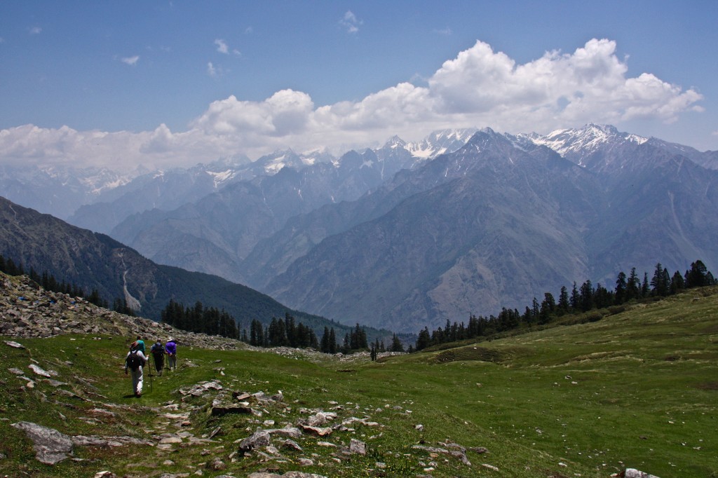
CDIndiaTrek 170As I sit cross legged in my tent, carefully setting my tin cup aside to cool, I open the books that have become my guides. Not trail guides that tell me to turn left at the big tree or cross the river near the bend, but guides for the mind and the eye as I follow in the footsteps of mountaineering icons.

“Mountaineering in the Garhwal and Kumaon Himalayas more nearly resembles mountaineering in Switzerland, the country is unspoiled by commercialism,” Frank S. Smythe wrote in his 1949 book The Valley of Flowers, which describes his expedition through this region. “There are no railways, power lines, roads and hotels to offend the eye and distract from the primitive beauty and grandeur of the vistas, and there are peaks innumerable, unnamed and unclimbed, of all shades of difficulty and valleys that have never seen a European, where a simply kindly peasant folk graze their flocks in the summer months.”CDIndiaTrek 074Smythe’s book, along with The Ascent of Nanda Devi by H.W. Tilman and Nanda Devi by Eric Shipton, are landmark accounts of early Himalayan mountaineering. All of them describe these very mountains and trails in Northern India as they were eight decades ago. Greener than the northern side of the range in Tibet and Nepal, India’s Garhwal region is filled with quiet valley villages and high meadows rich in grass, with each ripple of the landscape pointing the way deeper and higher into the world’s greatest mountain range.
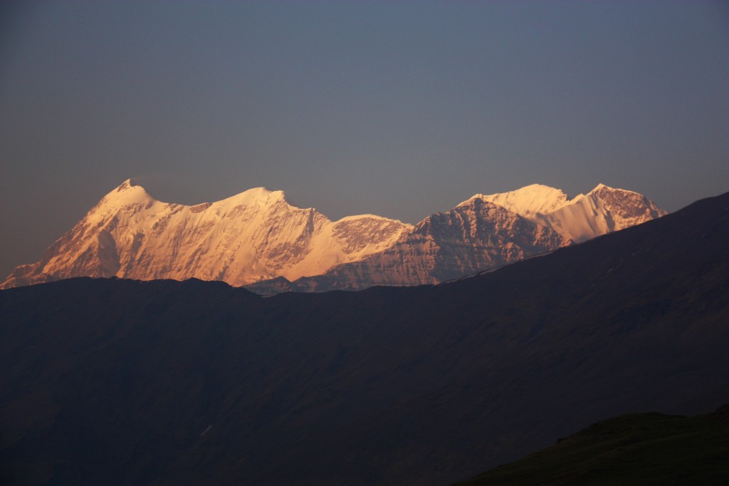
They were all drawn to the region by Nanda Devi, at 7816 meters the highest mountain in India, and at the time, the biggest in the British Empire. It stands in the middle of a basin ringed by 7,000 meter peaks, creating the famous Nanda Devi Sanctuary. We’re only trekking the approaches to the famed mountain, but these historic accounts spend many pages describing the same valleys and mountains we are traversing.

Times have changed since Smythe’s description, but Uttarakhand is still raw and undeveloped, the disadvantages of which became evident in June, 2013 when heavy rains caused devastating floods and landslides in the country’s worst natural disaster since the 2004 tsunami. More than 5,700 people were killed, and the army had to evacuate more than 110,000 people from the steep valleys in this mountainous state. The mountains stills how raw scars from landslides and the roads are still buried in rubble.

Today, there are roads and electricity, in places, but visitors are still few and far between. In ten days of trekking we do not see one other European trekker, and only a handful of local groups. We are trekking in high season, crossing and joining famous routes such as the Curzon Trail and Roop Kund Trail as we weave our way through the mountains towards the Kuari Pass, but still, we have the mountains to ourselves.
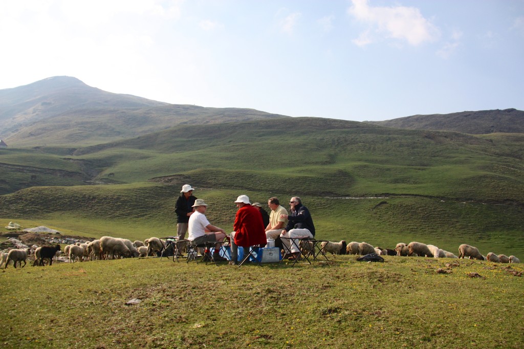
CDIndiaTrek 110Actually, we weren’t totally alone, as the high meadows were dotted with sheep chased up from the valleys for summer grazing. One morning we ate our breakfast under a cloudless sky, the rarefied Himalayan air sharpening every colour, ridge line and glint of sunshine that struck the rolling meadow. Our table, made from the tin chests used by the porters, was moved out of the dining tent to offer us an uninterrupted view of the string of snow-capped peaks on the horizon.

As we ate, hundreds of sheep made their way through our camp, bleating as they daintily picked their way between tents in search of fresh grass, the shepherd exchanging greetings with the porters as he slowly walked behind his flock. The flock opened and engulfed our breakfast table like a river around a rock. We sat, our tin cups of chai paused in mid air, watching them. Some of us scrambled for cameras, other broke into laughter at the absurdity of the scene.
CDIndiaTrek 076Our days fell into a comfortable rhythm. We awoke early and ate a hot breakfast that catered to Western tastes while the porters began breaking camp. Each day, as the tents came down, the porters built a pyramid of shiny tiffin boxes, lunches that were stuffed into rucksacks as we exited the camp and began the day’s hike.

We often began with a steep climb, as our camps were made in valleys, near water sources. Then, by noon, we’d be on a ridge, breathless from the work and thin air, our eyes roving across the spectacular skyline of peaks.

“As the drew is dried up by the morning sun, so are the sins of mankind by the sight of the Himachal,” reads the Skanda Puranam, an ancient Hindu holy text.
CDIndiaTrek 054
We would feast our eyes on the spectacle while devouring our lunches, resting for the afternoon push. By mid afternoon we’d amble into the next camp, having walked between 10 and 15 kilometres, and often climbed well over 1,000 meters during the day. The mules and porters, taking shortcuts and relying on legs stronger than ours, usually had the cook tent up by the time we arrived. Chai and snacks were quickly served. The platter of channa masala, a snack of chick peas with chopped tomatoes, onions and coriander, was passed around as we reflected upon what we’d seen on the trail that day.

It was then, aglow with the effort of the day’s hike and satiated by the tea, that we had our best opportunities to soak in the grandeur of the mountains. Some camps offered unobstructed views of the peaks, others were set beside rushing rivers or overlooking broad valleys. The light would soften, the air would cool until jackets were needed, and the camp became domesticated with strings of laundry and the smell of dinner underway.

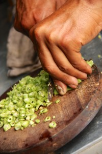
Dinner, we quickly learned, was not to be missed, as it consisted of at least four hot dishes, plus bread and rice. Suman, our cook, rarely repeated a dish on our 10 day journey. Rajma, dals, various paneer preparations, stuffed bitter gourd, chole battura and tibetan style dumplings were all prepared on two kerosene burners, with all supplies hauled on mules. When we were all sighing and setting our plates aside the waiters arrived at the dining tent with banana fritters in chocolate sauce, rice puddings and freshly baked cakes. We had to keep walking, or we’d grow fat.CDIndiaTrek 146
CDIndiaTrek 058Smythe’s book kept me scanning the high meadow passes and valley trails shaded by pine and chestnut trees, searching for the myriad of flowers he identified on his trek. The ground was carpeted in millions of tiny primula blooms, purple, red, blue and yellow, close to the ground to hide from the constant wind, unfaded by the baking Himalayan sun. There was the bright blue Eritrichium Strictum, which looked like a forget-me-not, the rare dwarf Iris Decora, and the Arum, or Arisema Wallichianum, a cobra headed plant that looked vaguely evil.

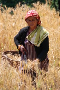
The meadows were also a source of riches for the isolated villages we came across. The Parahi herders were moderate Hindus, as influenced by the Buddhists to the north as their compatriots to the south, and we encountered them nearly every day on the trail, bodies hardened by their mountain life but smiles filled with warmth.

“The natives are short and sturdy, and fairer in colour than the inhabitants of the plains. Blue eyes and cheeks tinged with red are not uncommon and some of the women are very beautiful,” Shipton wrote of the locals eight decades ago, and his words still rung true.
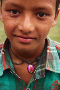
CDIndiaTrek 121They ranged the mountains tending their sheep, and, for a few short weeks each summer, in search of kira jhar, a fungus sold to Chinese medicine men as a treatment for lungs, kidneys and erectile dysfunction. It was the latter property that the village boys wandering through our camp told us about, giggling as they tried to explain. They knew it for that, and for its interruption to their play.CDIndiaTrek 123
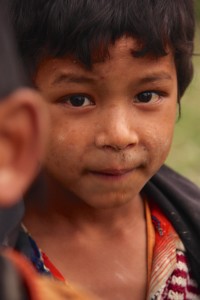
“We want to play cricket, but there’s not enough boys to make a game. Everyone is up in the hills, picking kira jhar” a barefooted boy said with a pout when asked why they were mopping about the camp.
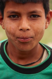
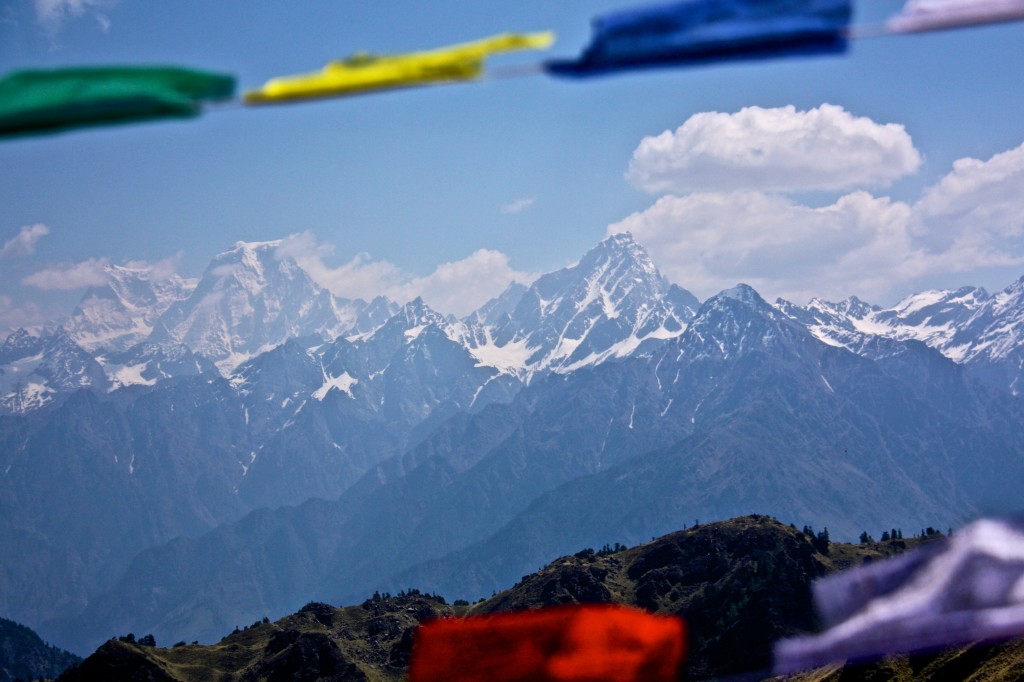
CDIndiaTrek 122It was on the high passes where I felt a little bit drunk. Not only because the altitude — we trekked as high as 4,100 meters — had me panting and dizzy with a dull ache behind my eyes, but because I could see forever. The mountain peaks, strung like jewels across the horizon, were intoxicating. Nanda Kot,Trisuli, Nanda Gunti and Mrithuni, a series of 6000 and 7,000 meter peaks, appeared repeatedly, like old friends on the far side of a river. Catching the gleam of the first morning sun here, shrouded in fog there, bathed in a golden sunset as seen from our campsite. There was still plenty for me, as an inexperienced trekker, to aspire to.

“In Britain the atmosphere subtly deceives our estimation of height and distance, but in the moisture-free atmosphere of the Himalayas the peaks look high because they are high. At midday they gleam like polished steel under a nearly vertical sun and the eye sinks with relief to the green valley floor,” Smythe wrote.

Tilman, infamous for his tetchy nature, was far more perfunctory in his descriptions of the region than Smythe and Shipton were, but even he expressed admiration for the “peculiar nature” of the landscape, where valleys at 1000 meters are filled with lush green vegetation, while snowy 7000 meter peaks are visible only 20 or 30 kilometres away. That lushness, and its few visitors, is what sets the Indian Himalayas apart from visiting the same mountain range in Tibet and Nepal. The Indian, or southern, side of the range enjoys summer monsoons, while the northern flank is much drier.

“The whole country is an intricate tangle of valleys and ridges with their attendant ravines and spurs, which, even in the foothills, are all on a scale undreamt of in this country,” Tilman wrote.

We’d set out on this trek to reach the Kuari Pass. It’s name, meaning virgin, was given by Lord Curzon, the Viceroy of India, in 1905, when he became the first to cross it. Or, at least it was the first time it was crossed by a man who had the means to report his success back to London.
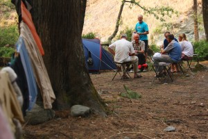
CDIndiaTrek 103We approached the pass on the penultimate day, and pitched our tents next to the sheep herders on the Dhakwani meadow, just as Shipton did.

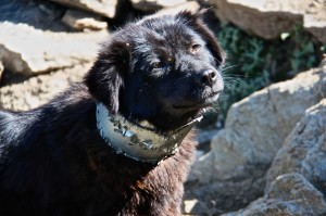
“The tinkle of sheep bells and the plaintive notes of a shepherd’s pipe drew us towards as shepherd encampment, and here we spend the night, a thousand feet below the pass,” I read in his book as a shepherd chases his flock of sheep through our camp, the beasts bleating and tripping over our tent guy wires. Sheep dogs nipped at their heels, their neck kept stiff by the tin collars they wore to protect them against marauding snow leopards.
CDIndiaTrek 160Tents were set up in a race against the clouds that were sinking ever lower, and which finally doused us in a cold, driving rain just as camp was made. That night, huddled together for warmth in the dining tent, taking extra servings of chai to stave off the cold, we speculated over what the next day would bring.

“It won’t take long to climb up to the pass in the morning,” Archit, our guide said. “This rain will end tonight, and it should clear the atmosphere and make the visibility really good.”

I crawled into my sleeping bag that night listening to the ping of raindrops on nylon, thinking of the sacredness of these mountains. We’d been on the trail for more than a week, and I felt a changed person for it, whether it was the gods or the fresh air. If the sights of the Himachal had not completely dried up my sins, they had at very least created a thirst to return.

The next morning we cross the pass, which gave us views of Kedarnath, Badrinath, Kamet and Hathi Parbat, the hewn rock and glittering snow that Shipton described as “one of the grandest mountain views in the world.”

He found it “difficult to refrain from gasping at the vastness of the scene,” and I realised nothing much had changed since the first explorers passed this way.
CDIndiaTrek 167


Montana Screening

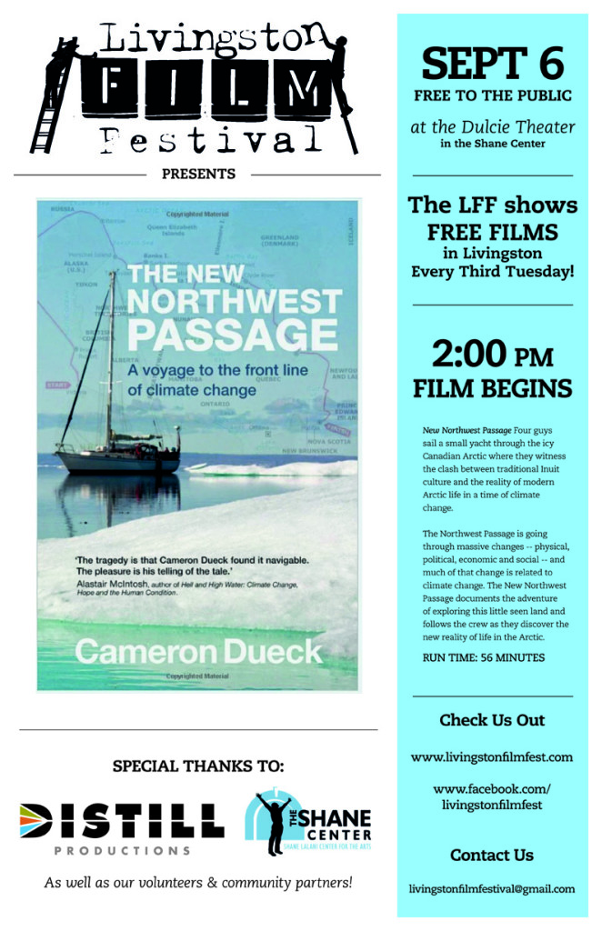
I’m very pleased to tell you that my film, The New Northwest Passage, will be screening at the Dulcie Theater in Livingston, Montana on Saturday, September 6 (2pm).

The screening is part of the Livingston Film Festival Series and the Last Best Fest, their annual arts festival.

Unfortunately I won’t be there for the screening, but if you’re in Montana you can be there in my place!

northwest-passage

Jump Cut to the Arctic

I’m very pleased that the young curators at JUMP CUT Independent Film Festival in Hong Kong have chosen to show my documentary, The New Northwest Passage!
The New Northwest Passage
Wednesday, April 16, 7pm (Contact the festival for tickets)
The Hive 21/F, 23 Luard Rd, Wanchai

It’s a cool new pop-up festival happening in April using some very innovative spaces around Hong Kong, presented by Hong Kong Youth Arts Foundation and aimed at nurturing the next generation of independent filmmakers and consumers.

fest

This festival is run entirely by the JUMP CUT youth committee, comprising passionate and determined young film-lovers selected through a recruitment process. With guidance from staff at YAF and experts from the industry, this team is given the thrilling but challenging task of running a festival. From curating the programme and selecting films to inviting guest speakers, writing reviews and organising scriptwriting and storyboarding workshops for other young people, the JUMP CUT youth committee experiences all the magic that happens behind the scenes.

By exposing young people to non-mainstream film culture and creating an intimate community of like-minded people, the youth committee is a place where ideas, experiences and emotions are shared, and where team members inspire one another.